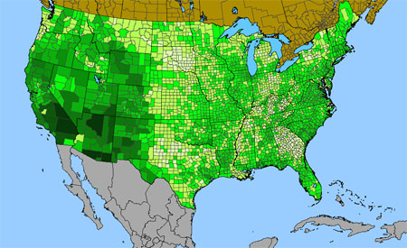
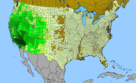
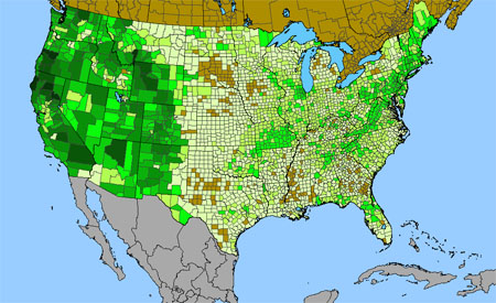
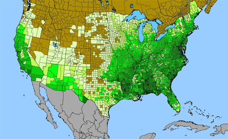
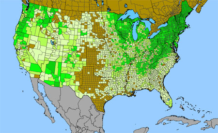
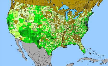
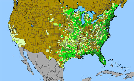
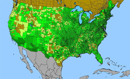
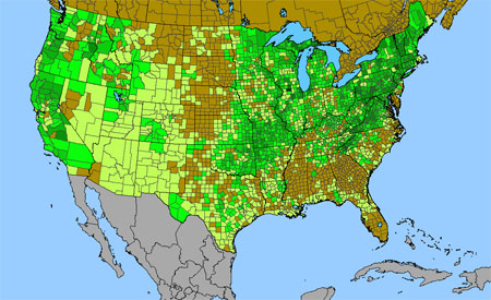
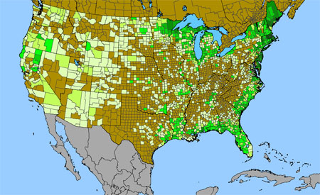
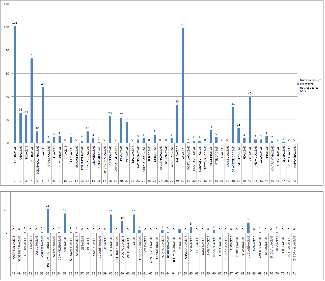
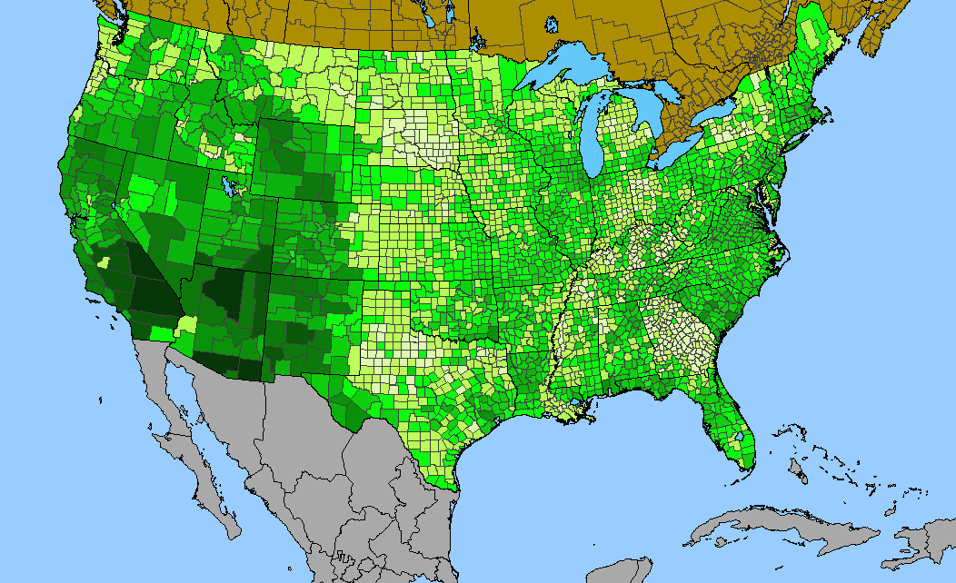
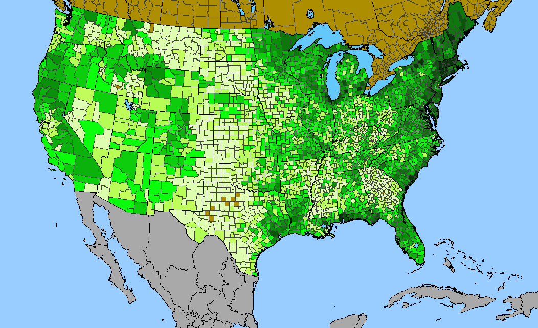
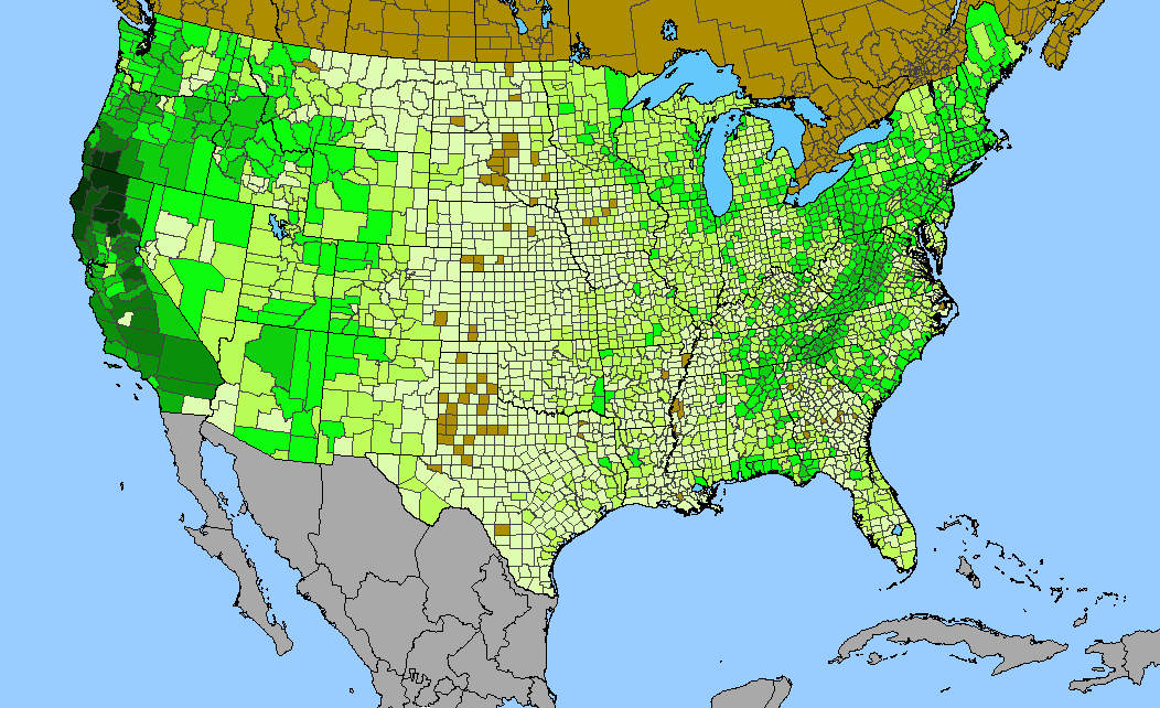
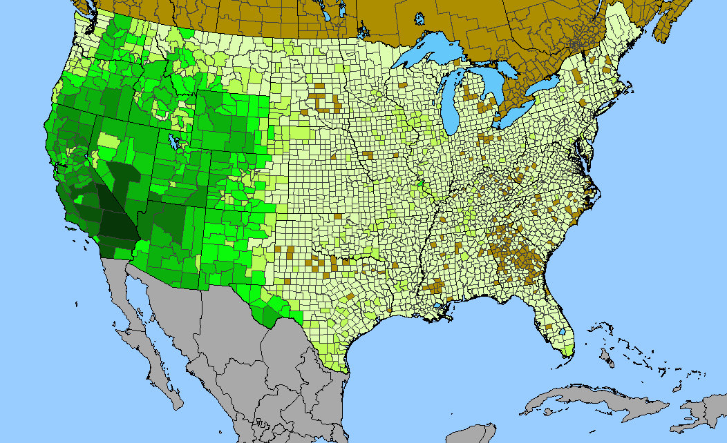
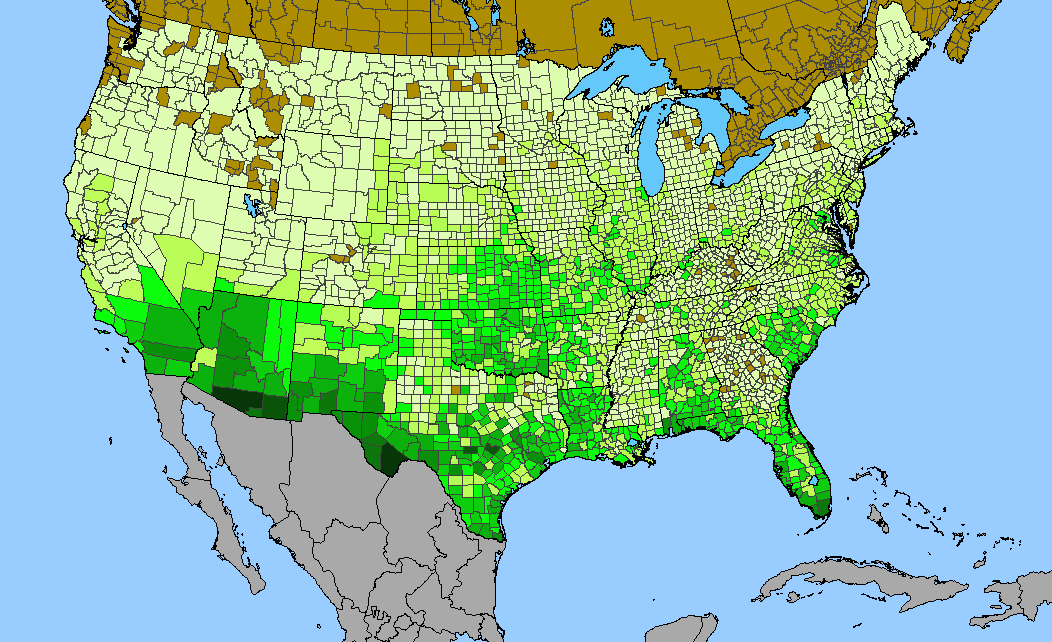
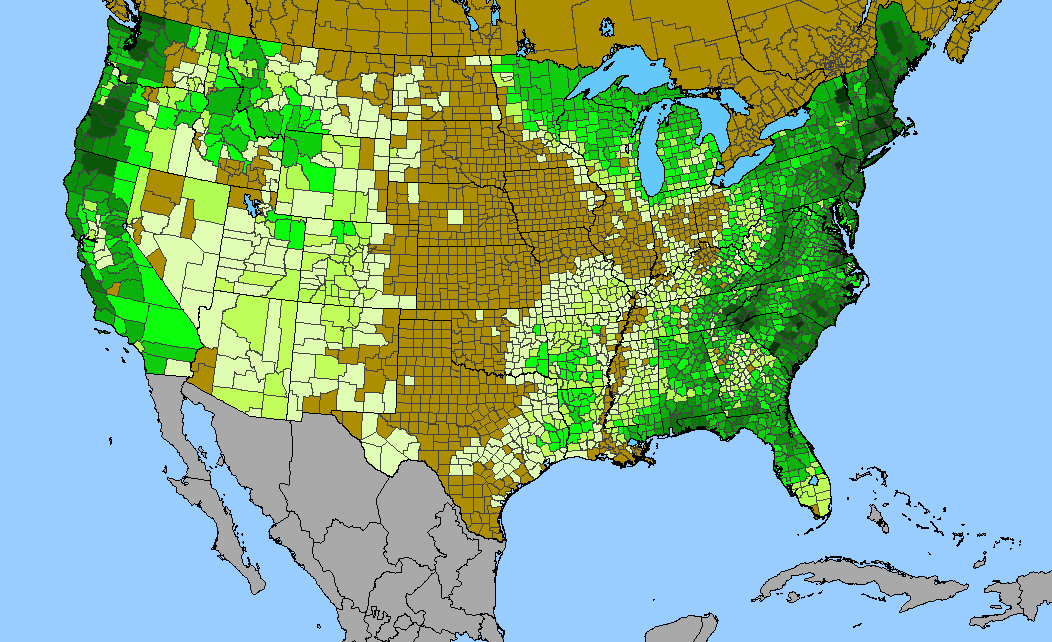
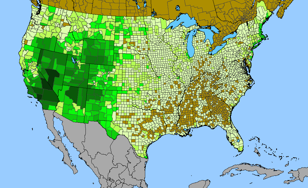
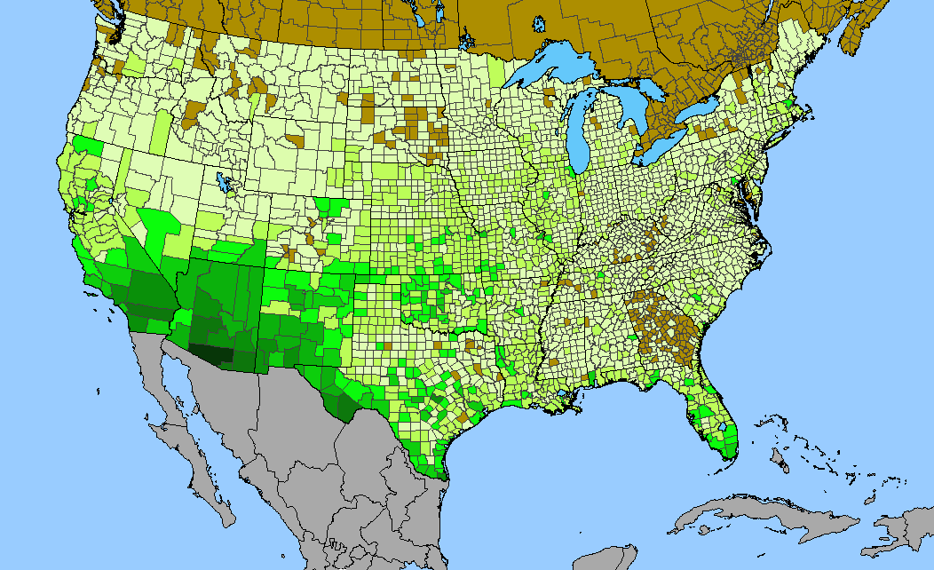
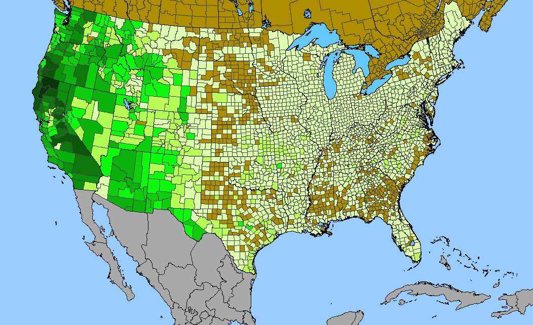
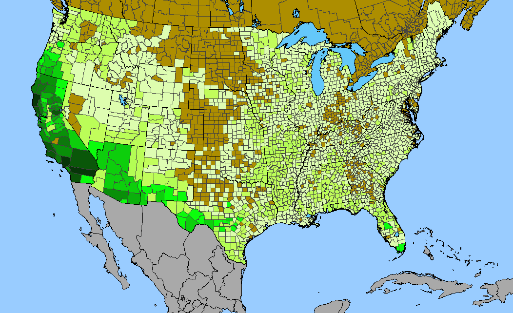
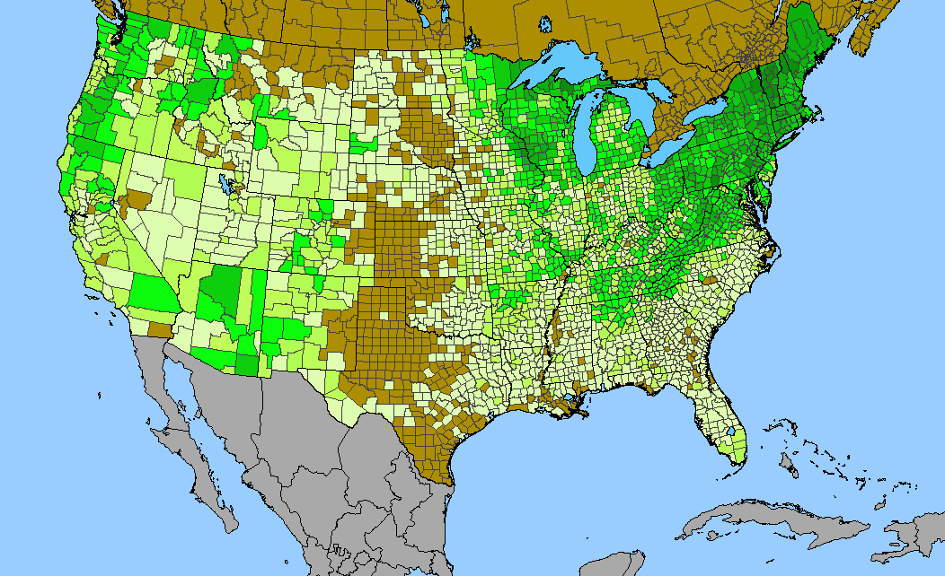
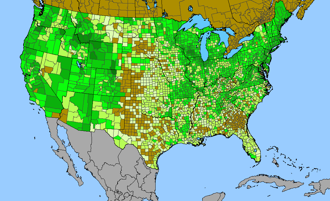
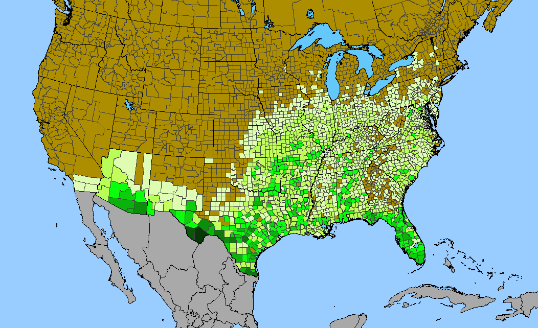
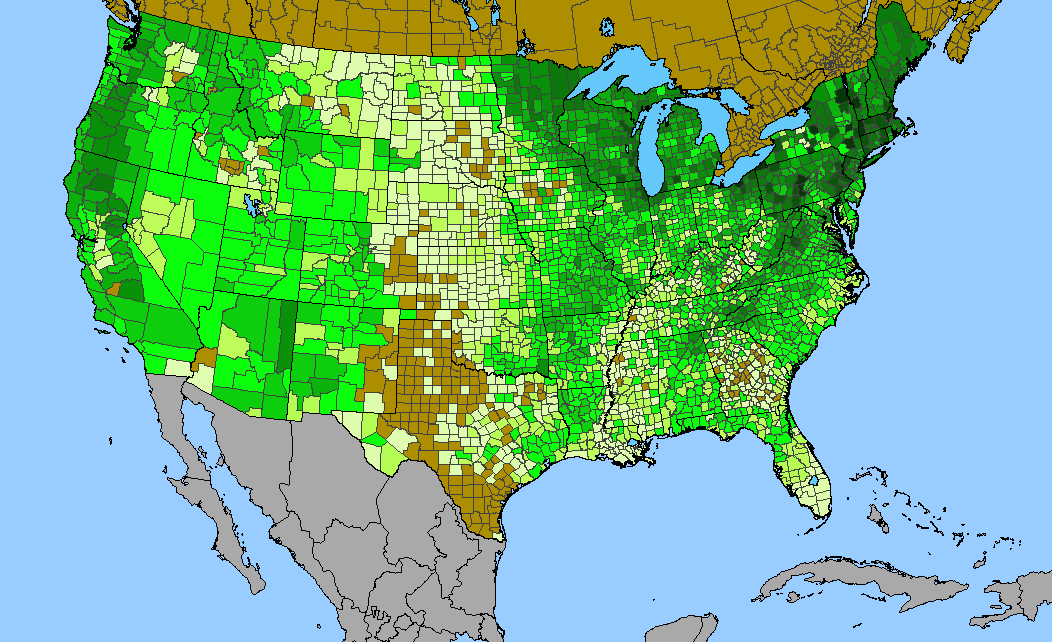
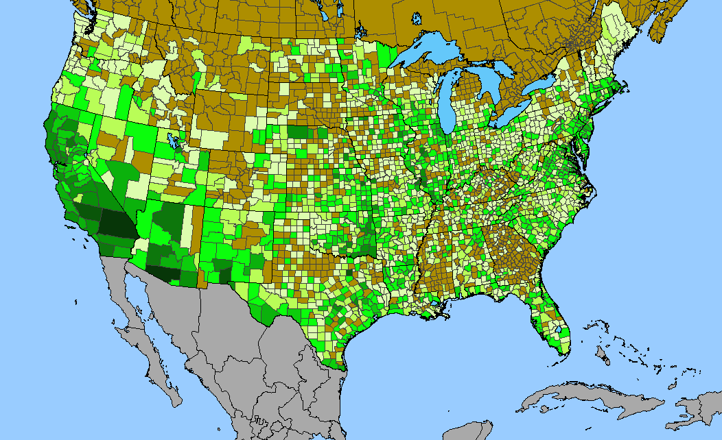
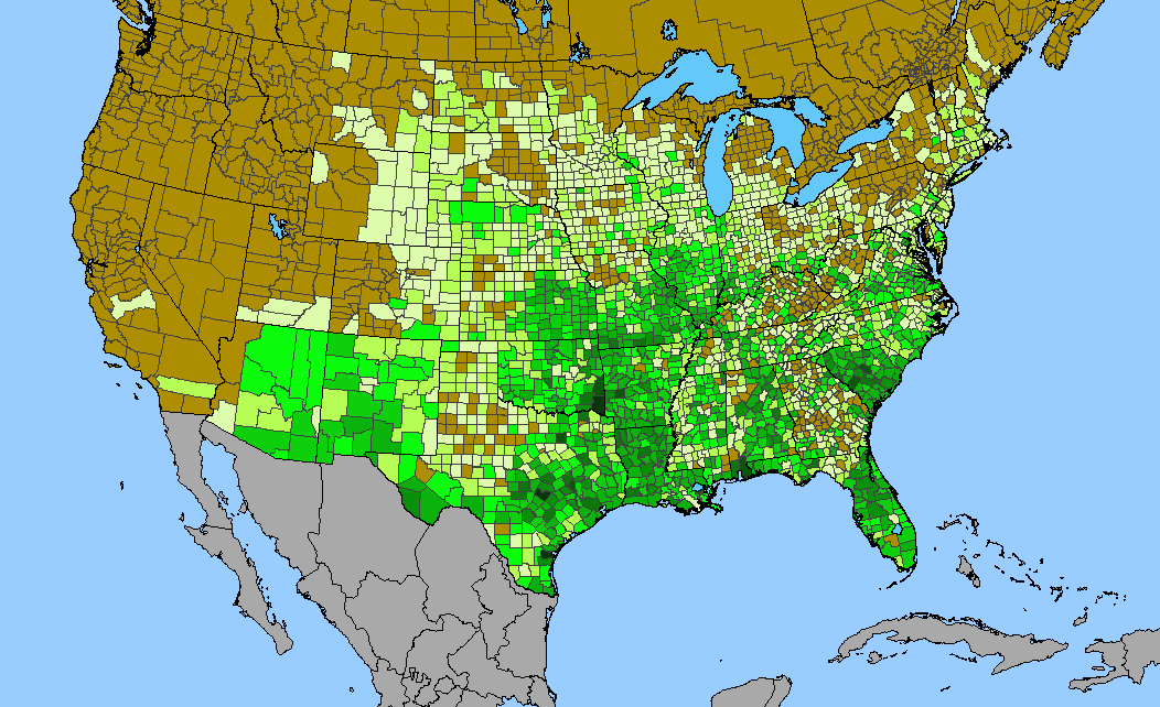
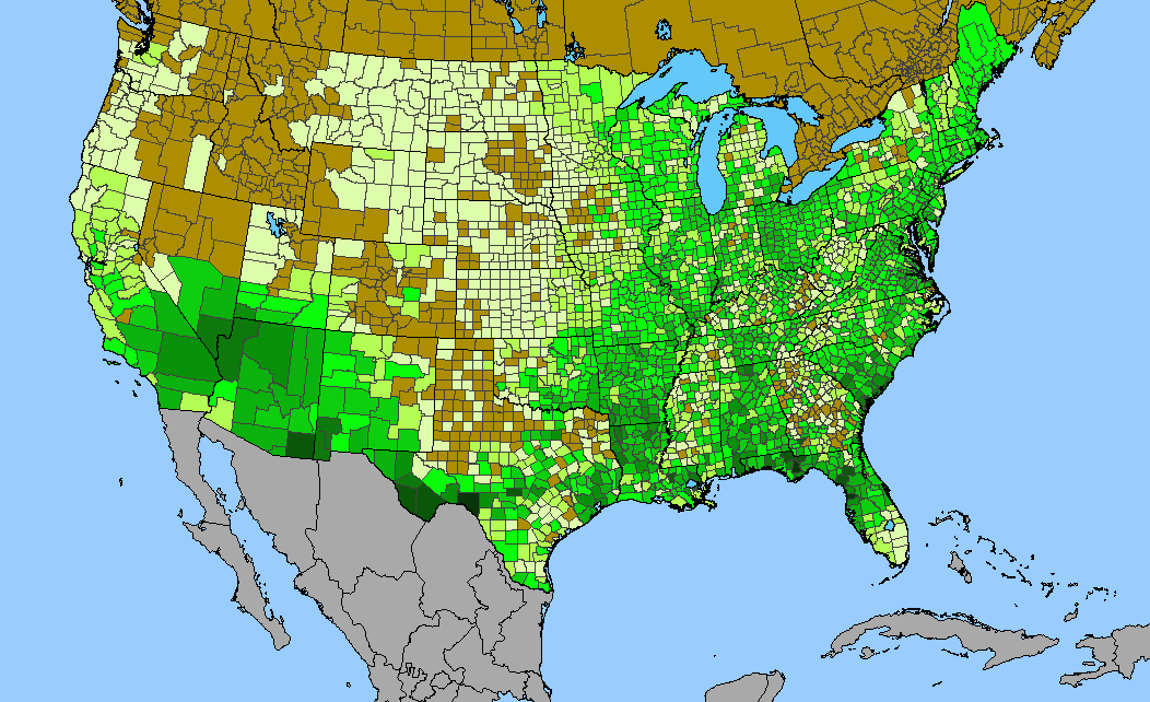
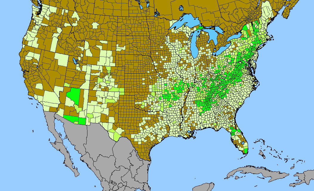
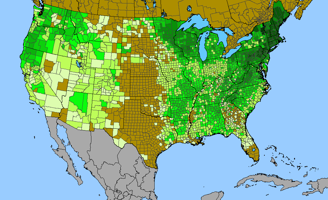
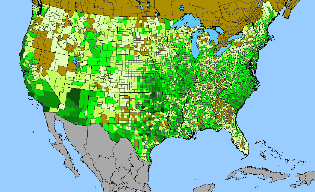
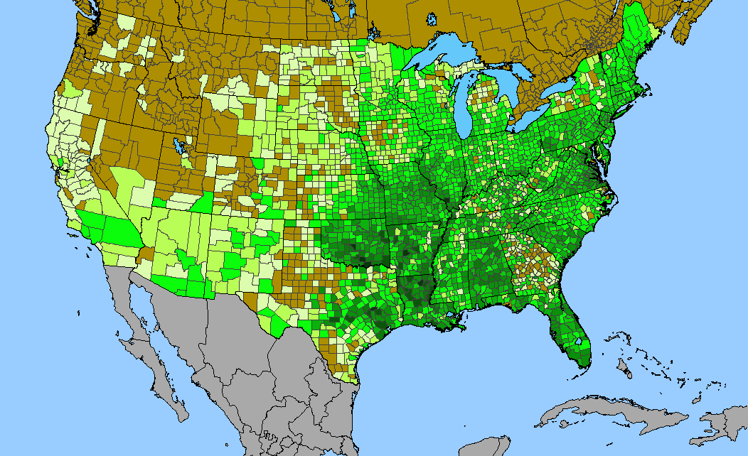
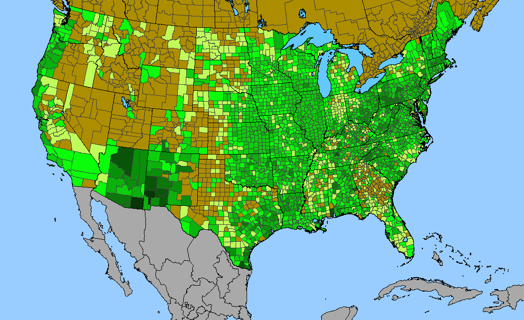
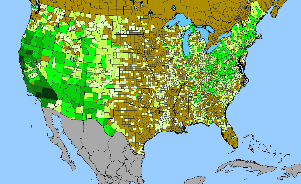
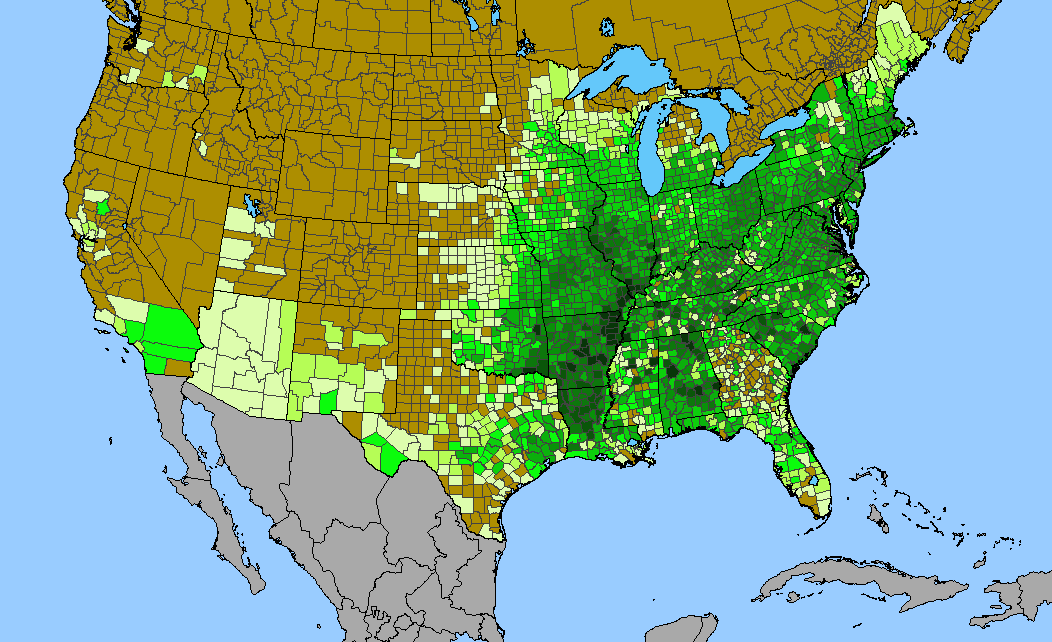
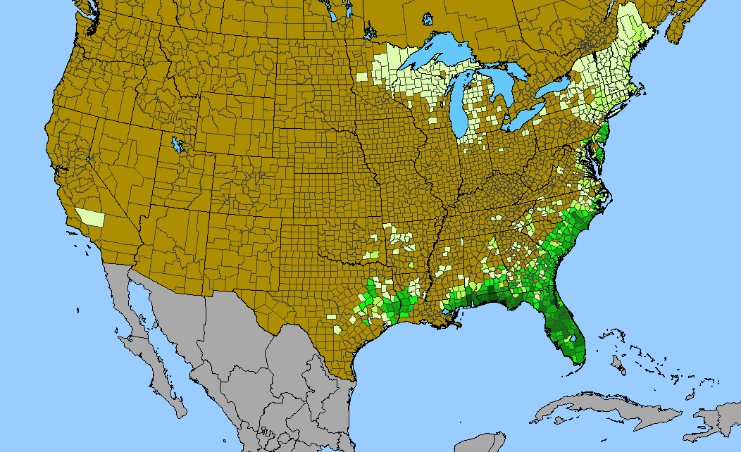
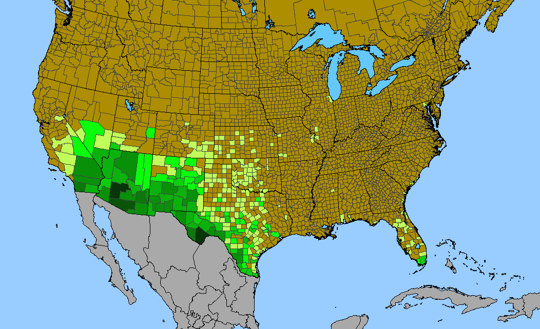
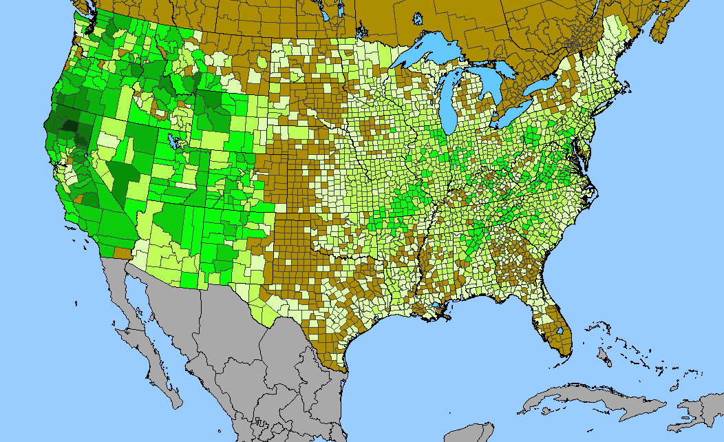
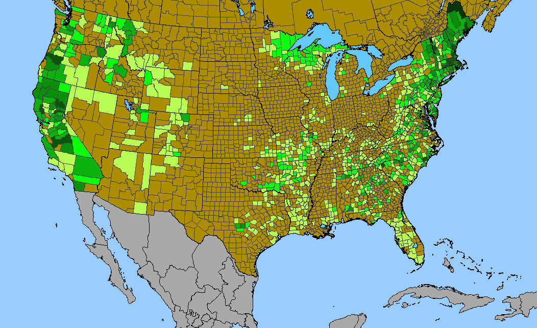
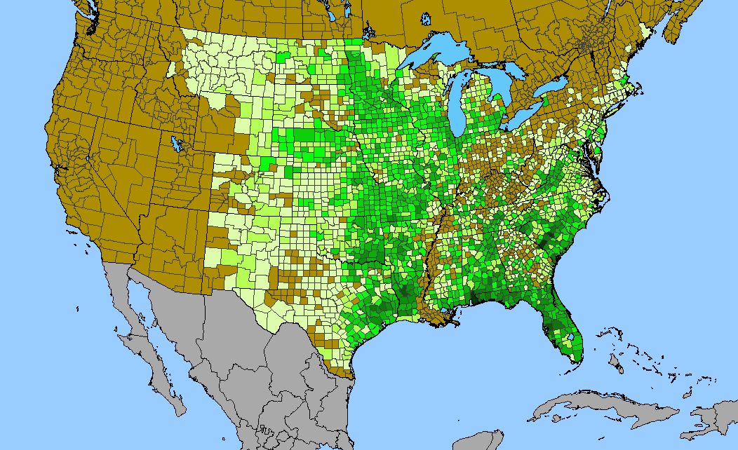
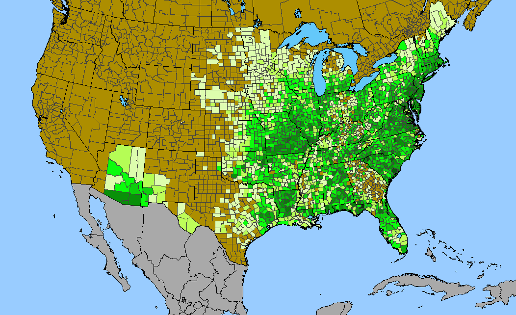
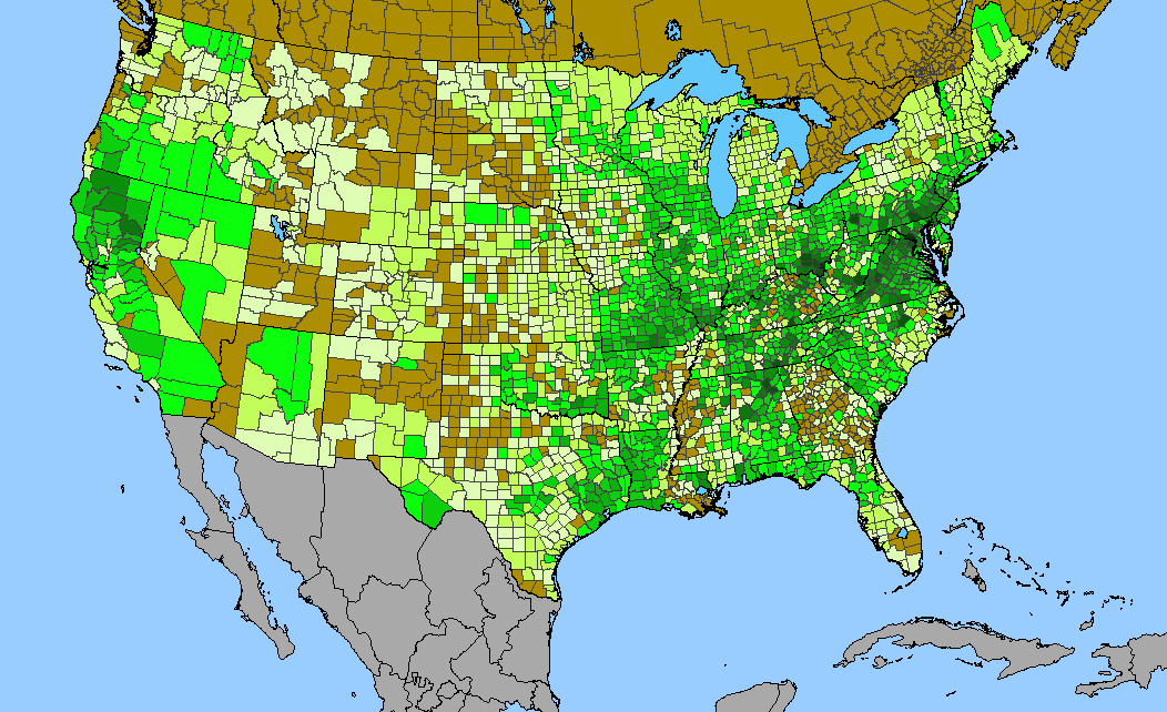
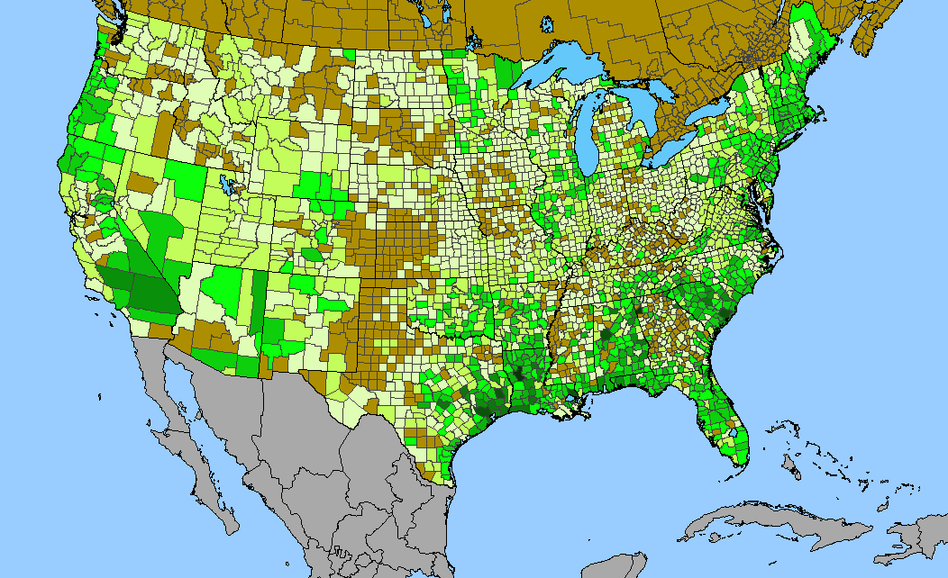
Density gradient of native species for ASTERACEAE within the US (data 2011). Darkest green (331 spp. Coconino County, AZ) indicates the highest species concentration. ©BONAP | 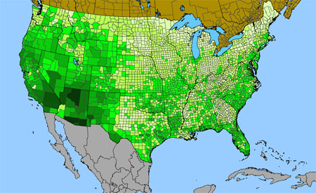
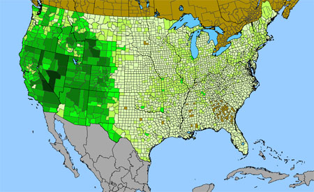
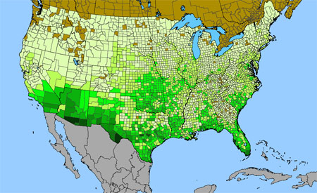
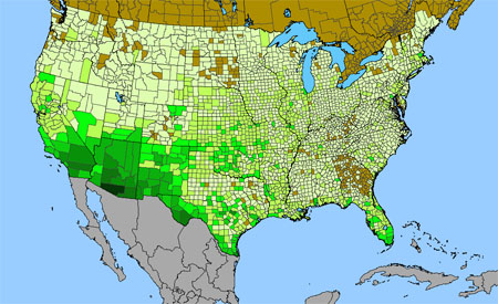
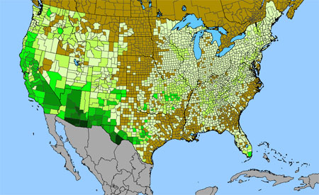
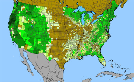
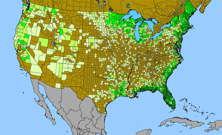
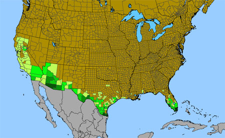
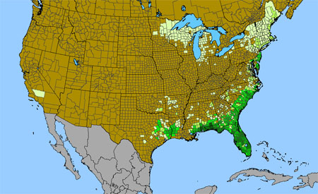
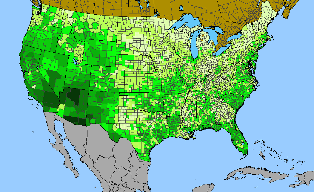
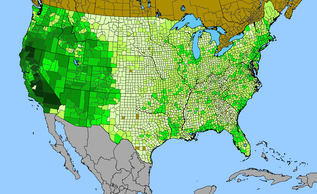
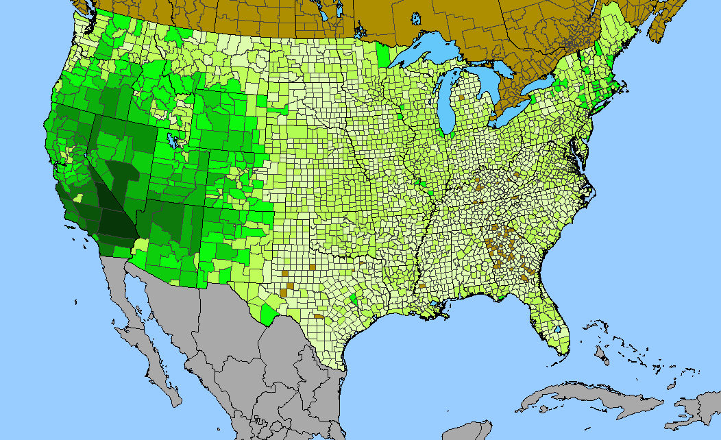
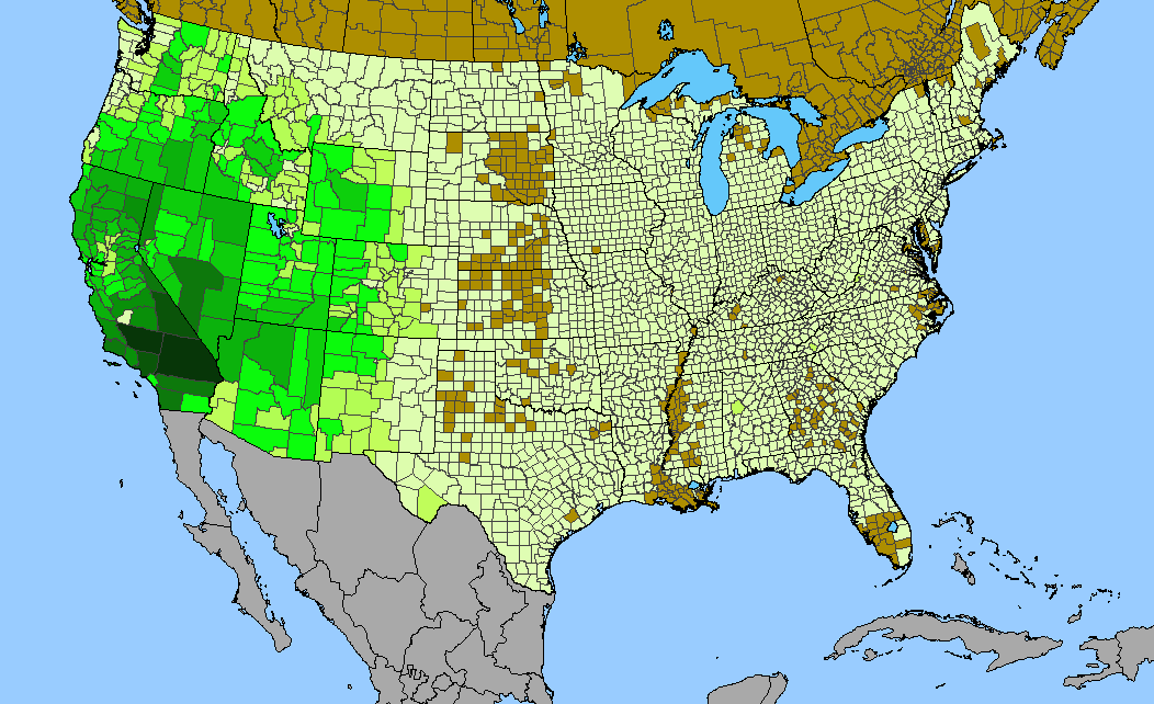
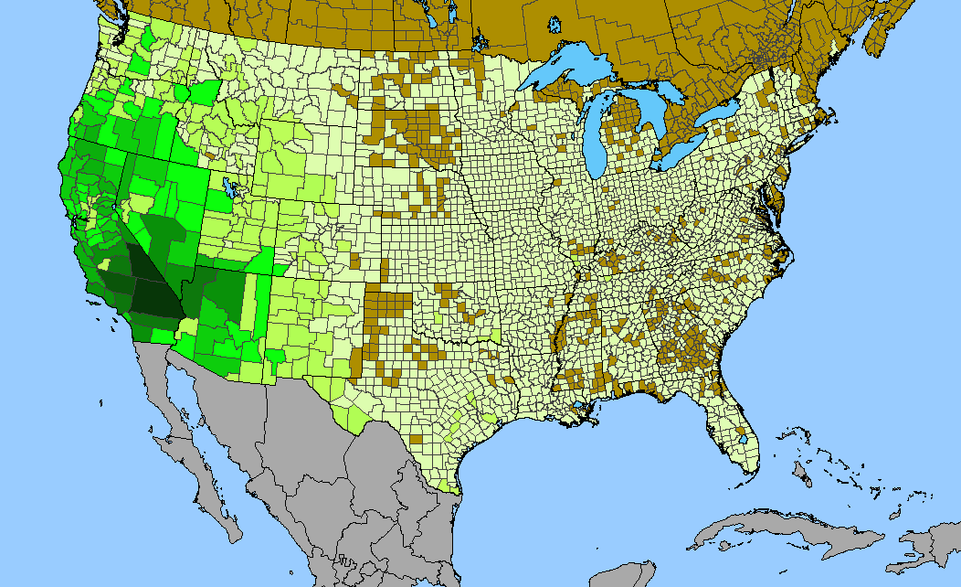
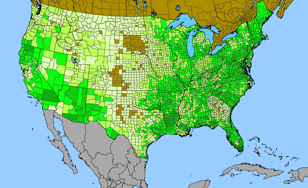
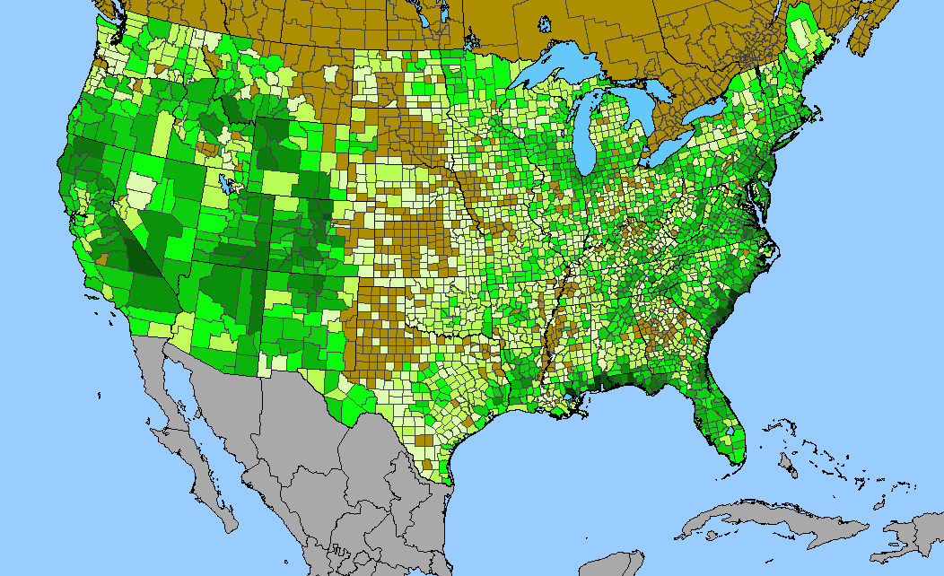
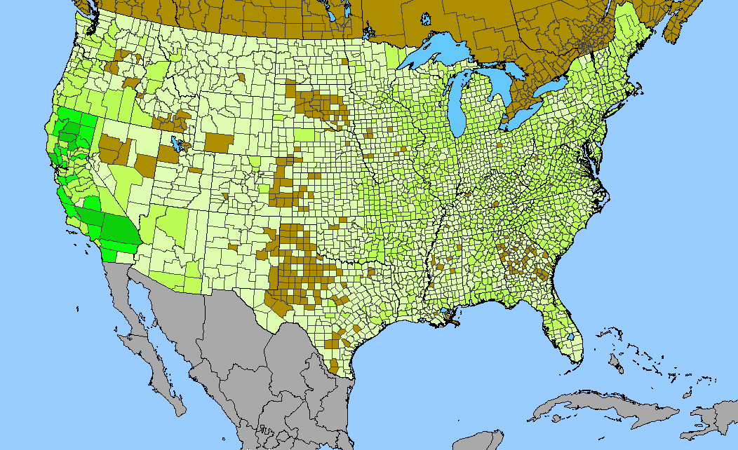
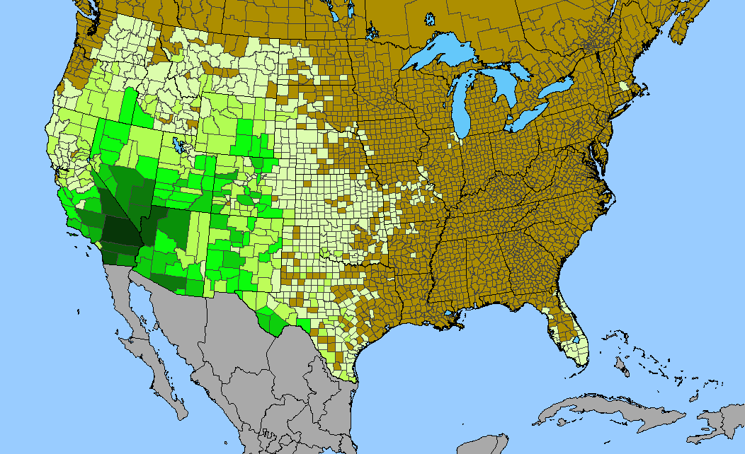
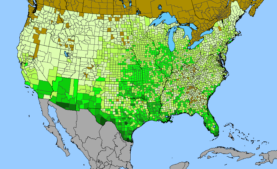
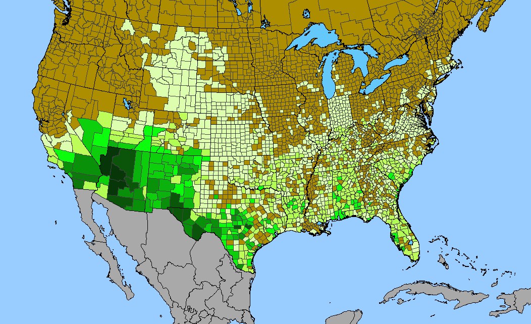
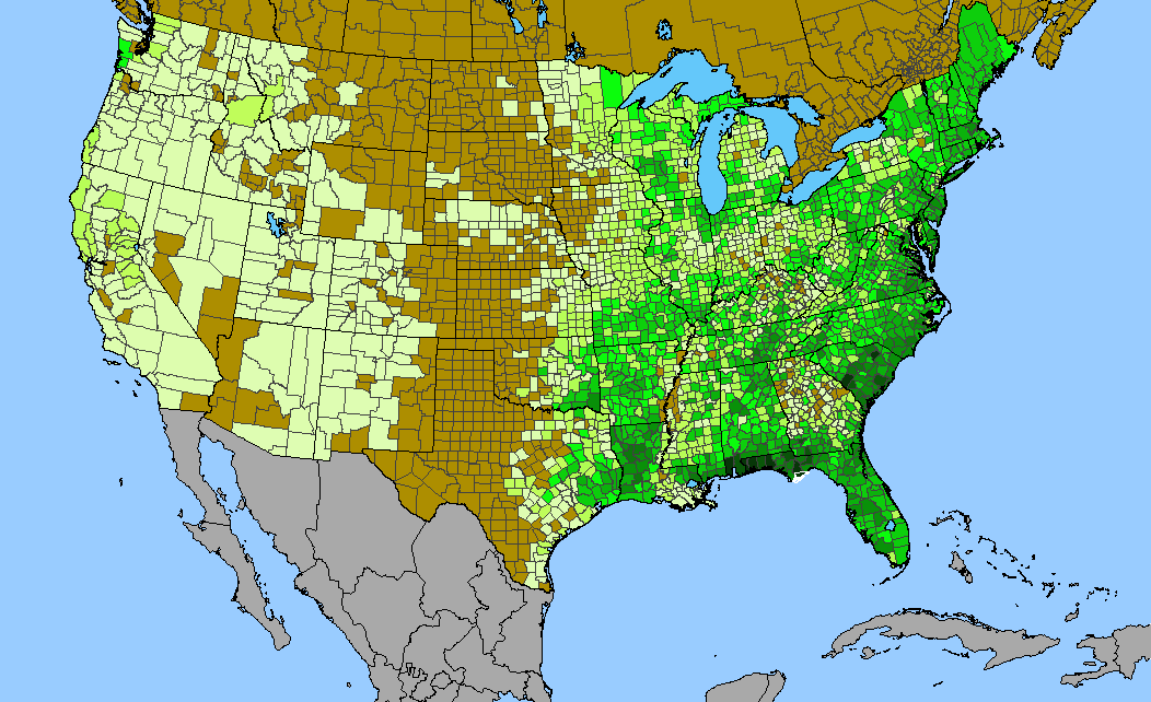
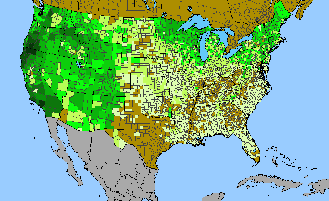
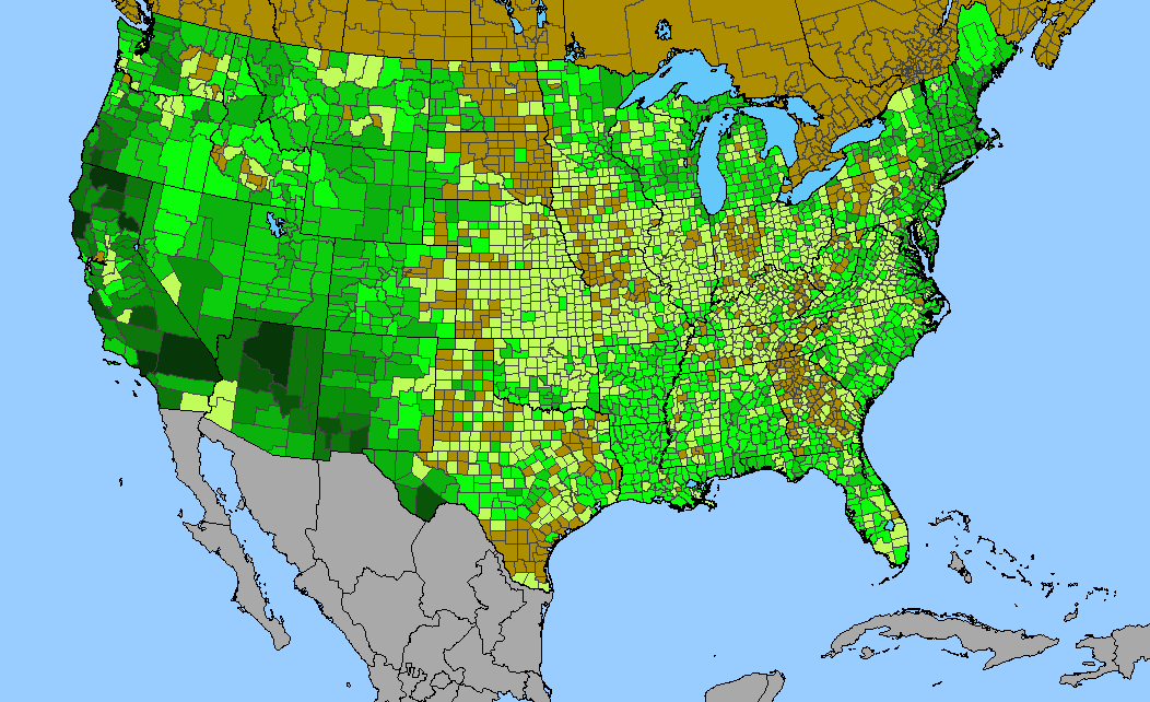
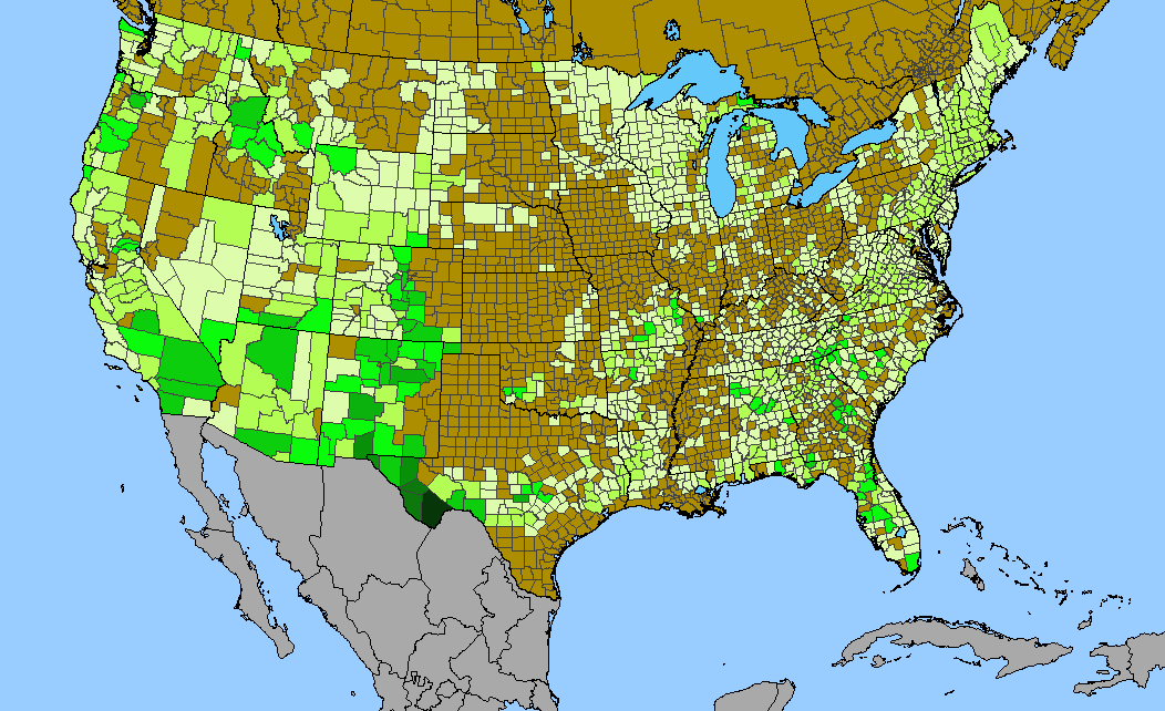
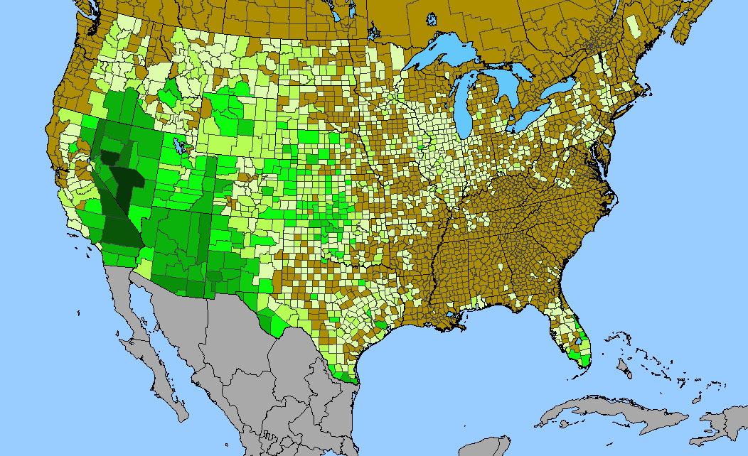
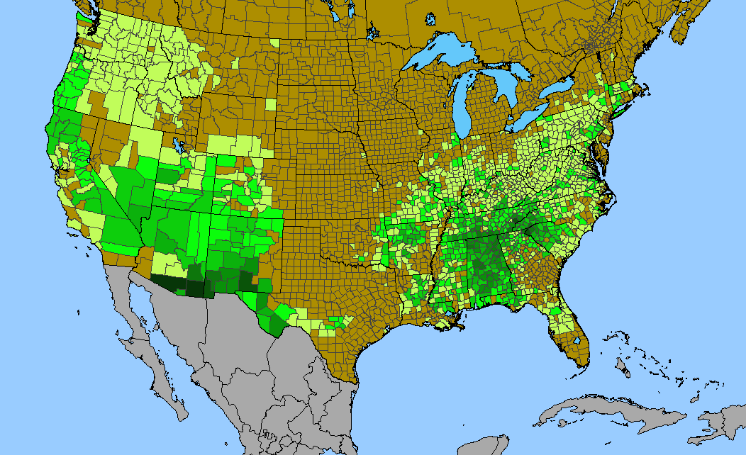
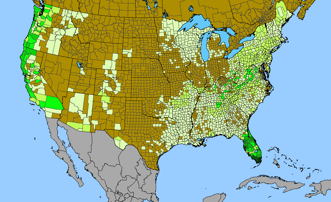
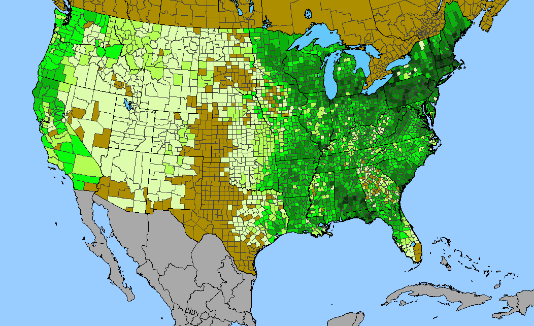
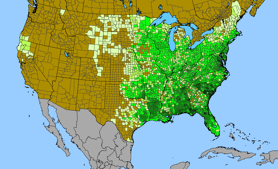
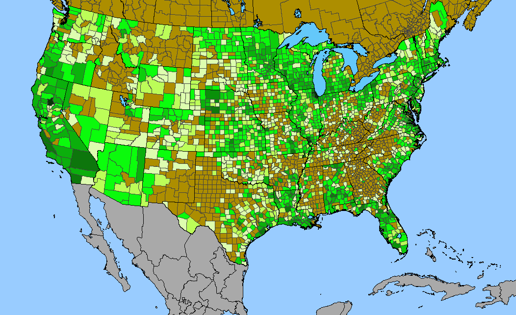
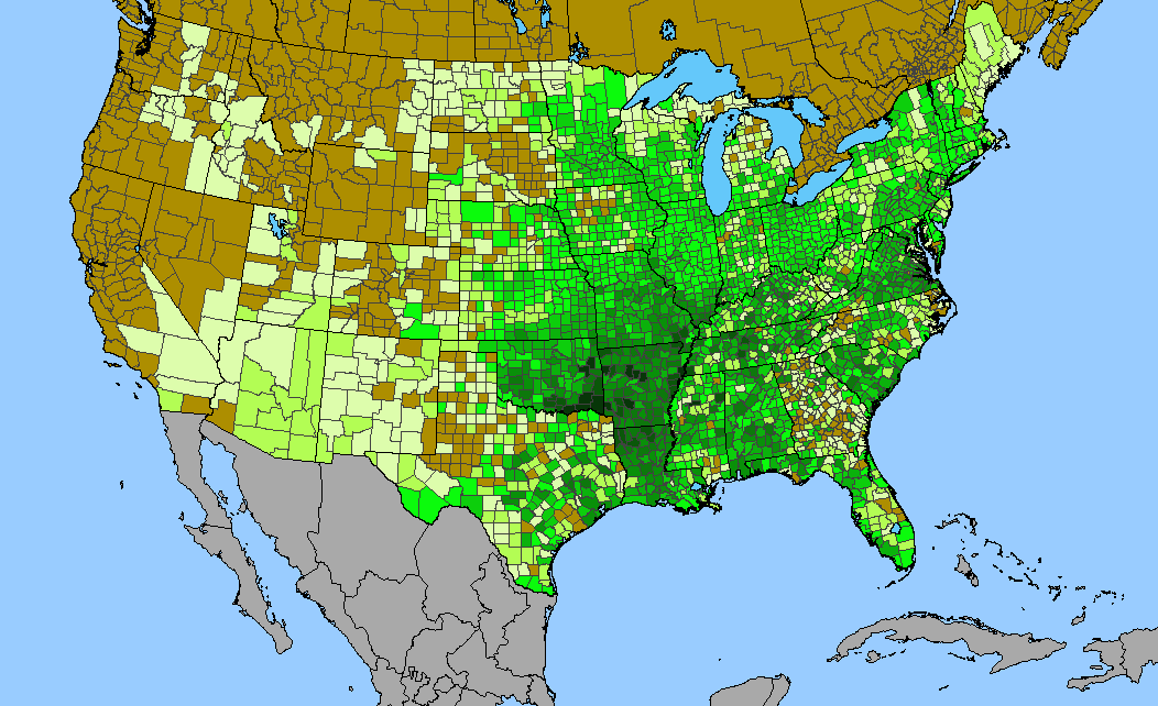
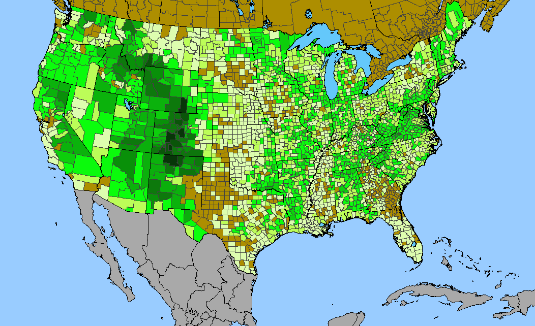
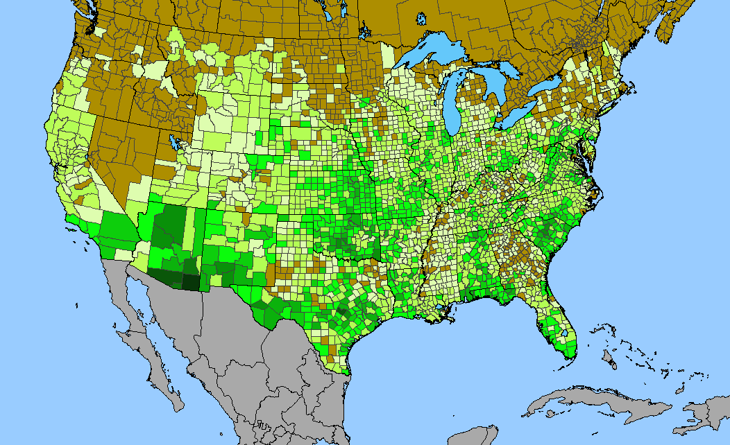
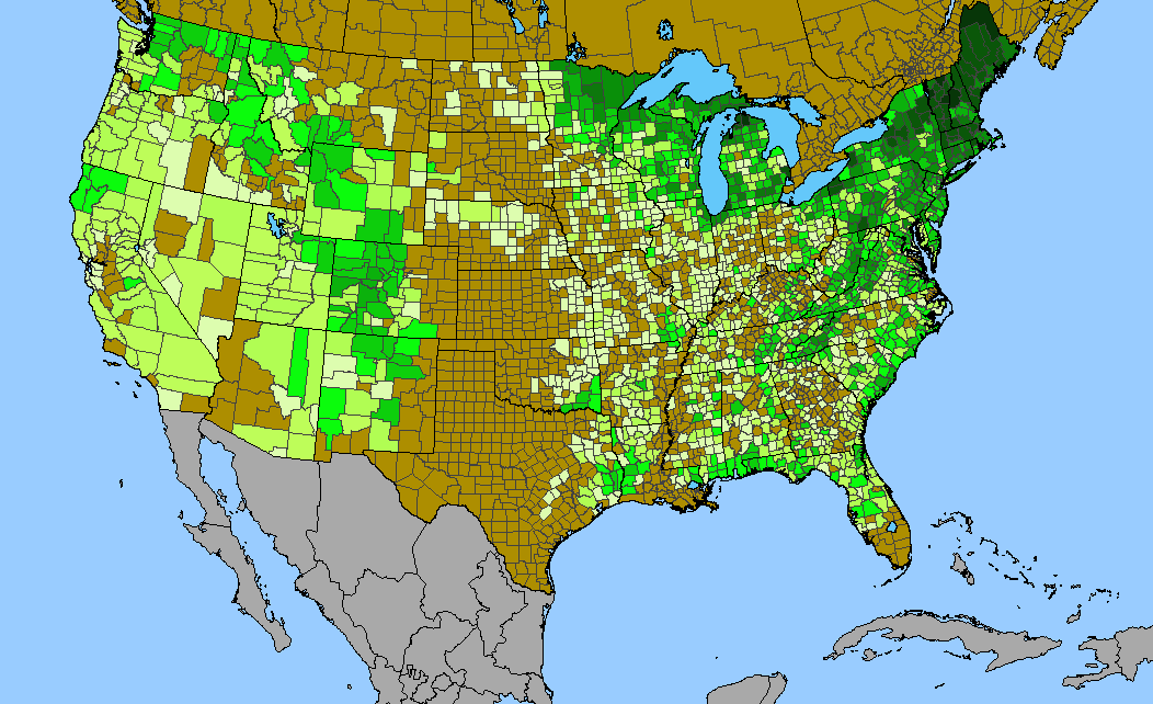
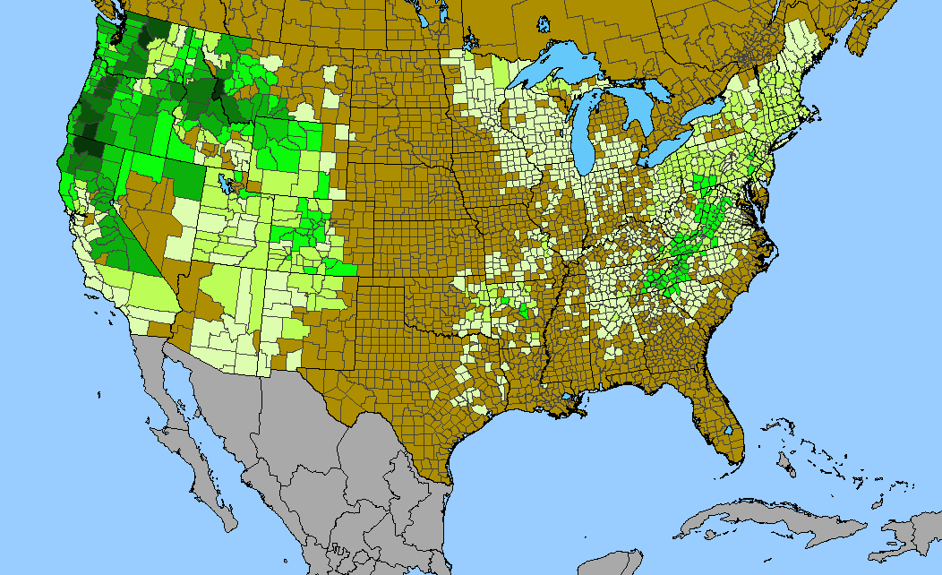
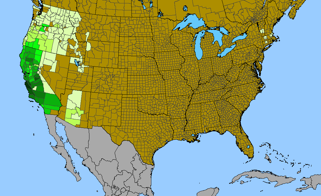
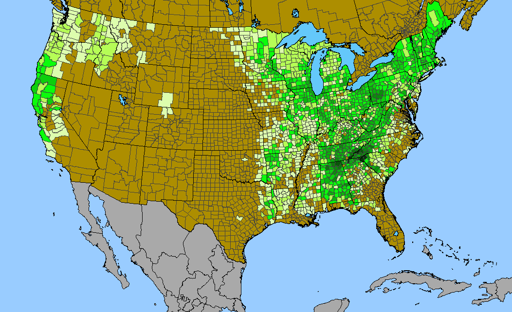
Density gradient of native species for FABACEAE within the US (data 2011). Darkest green (155 spp. Coconino County, AZ) indicates the highest species concentration. ©BONAP | 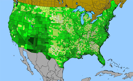
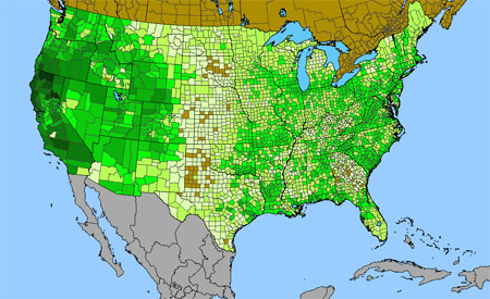
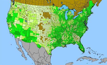
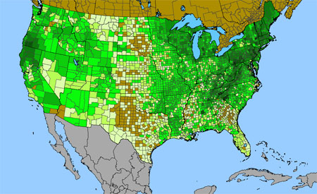
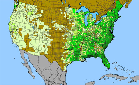
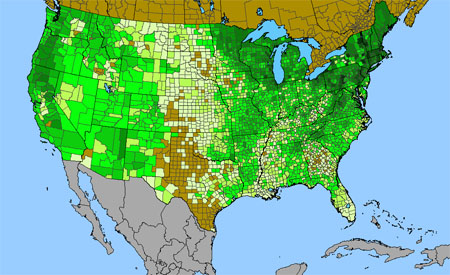
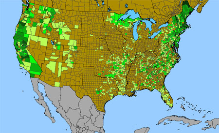
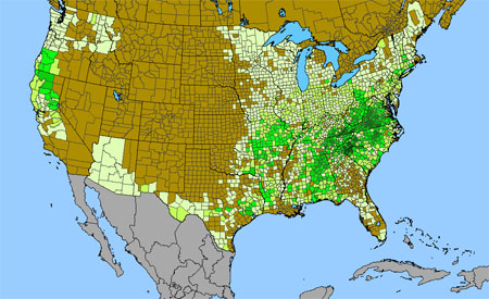
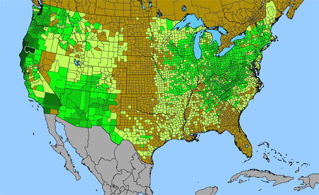
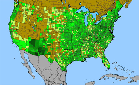
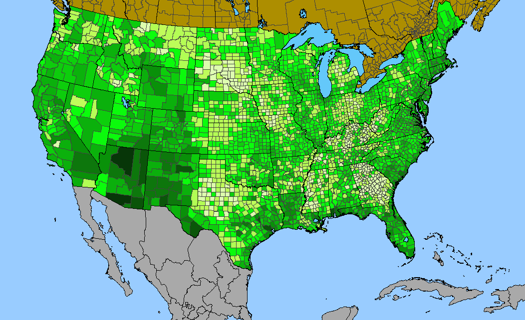
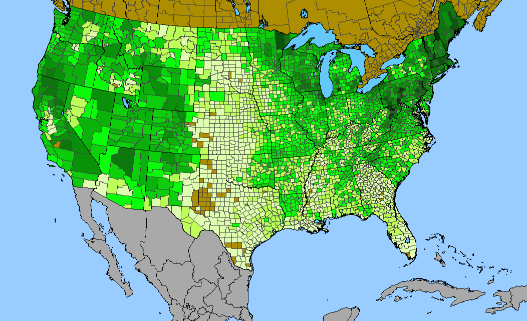
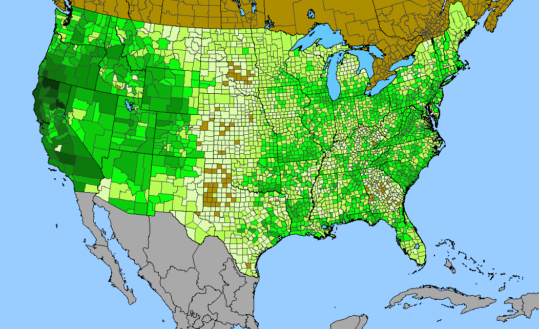
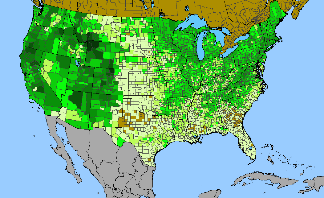
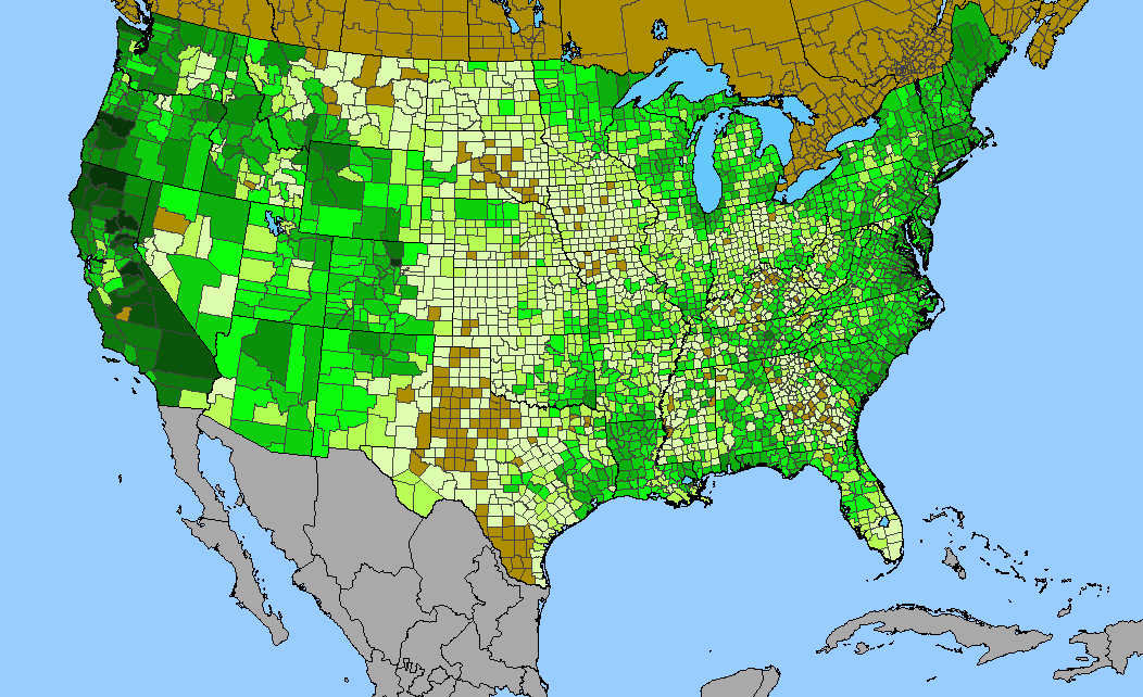
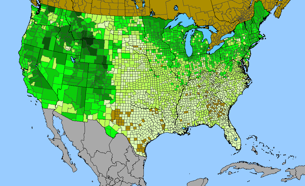
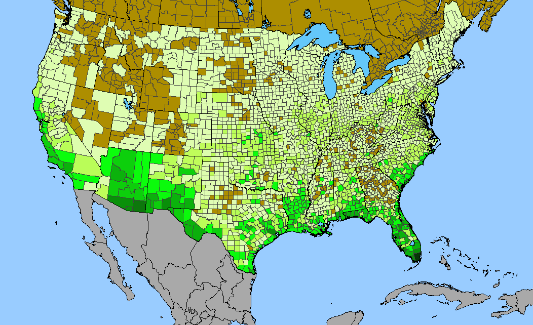
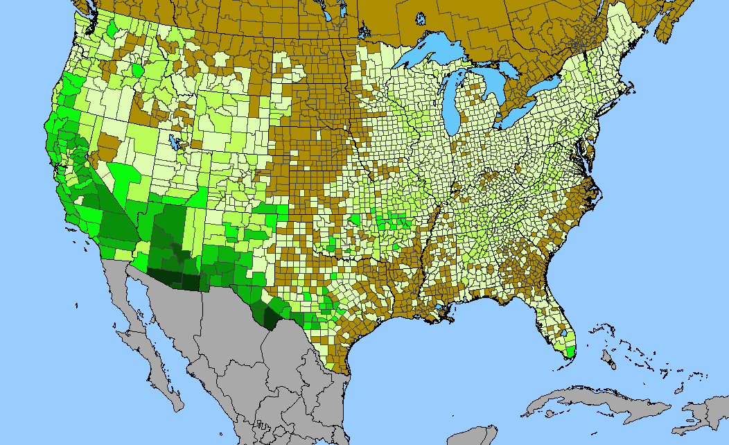
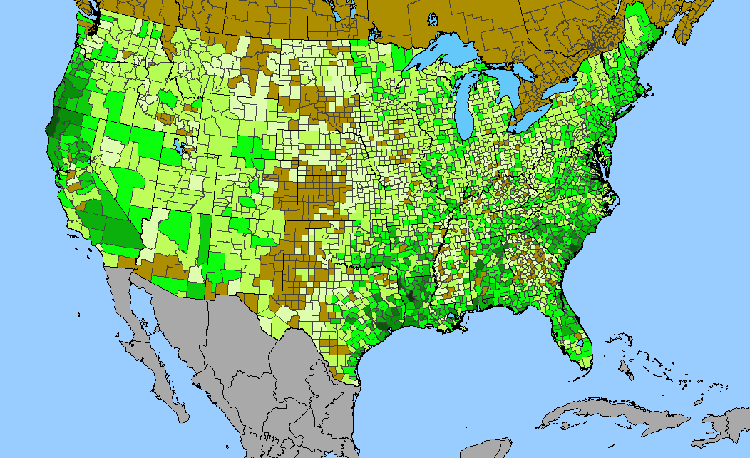
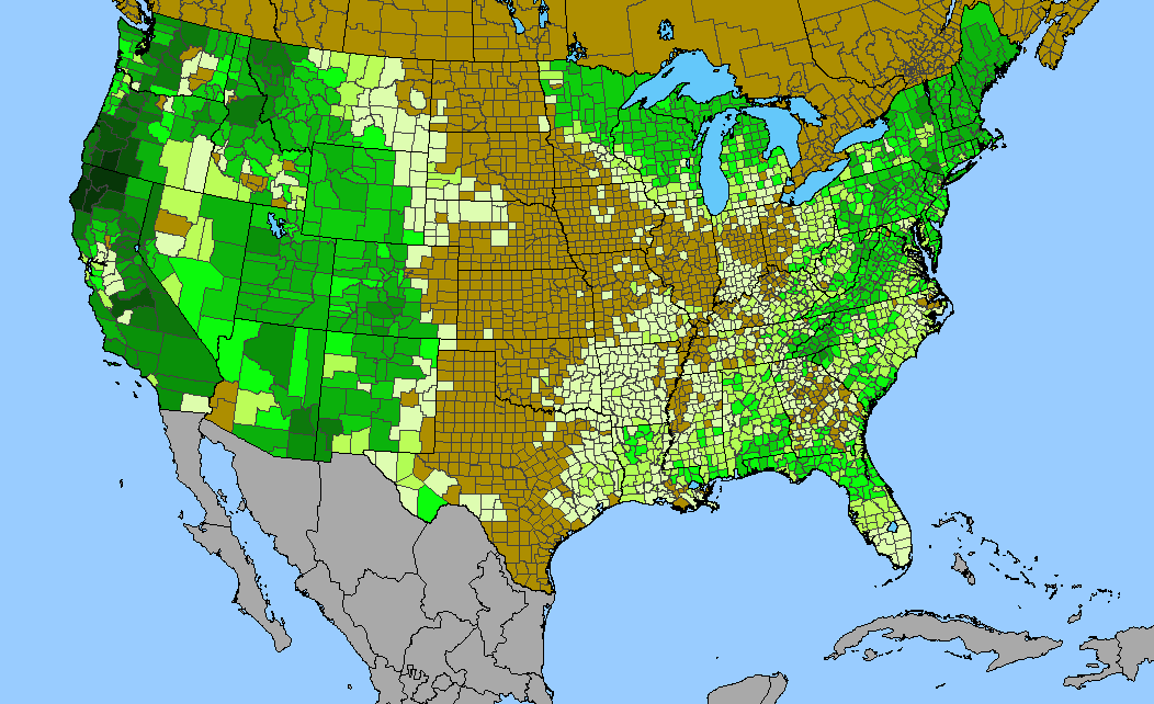
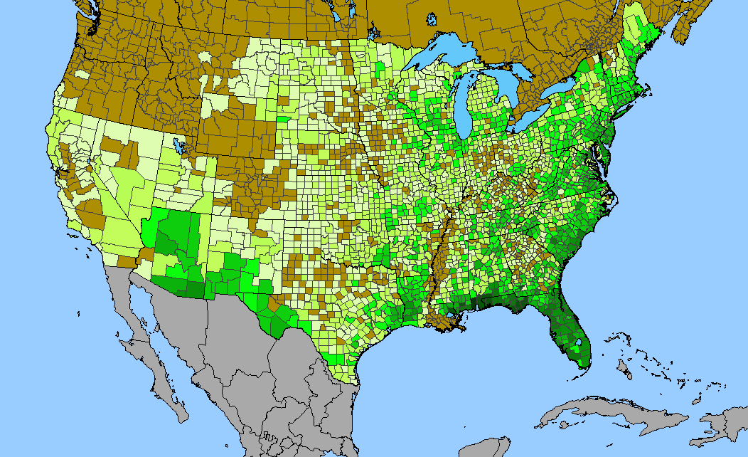
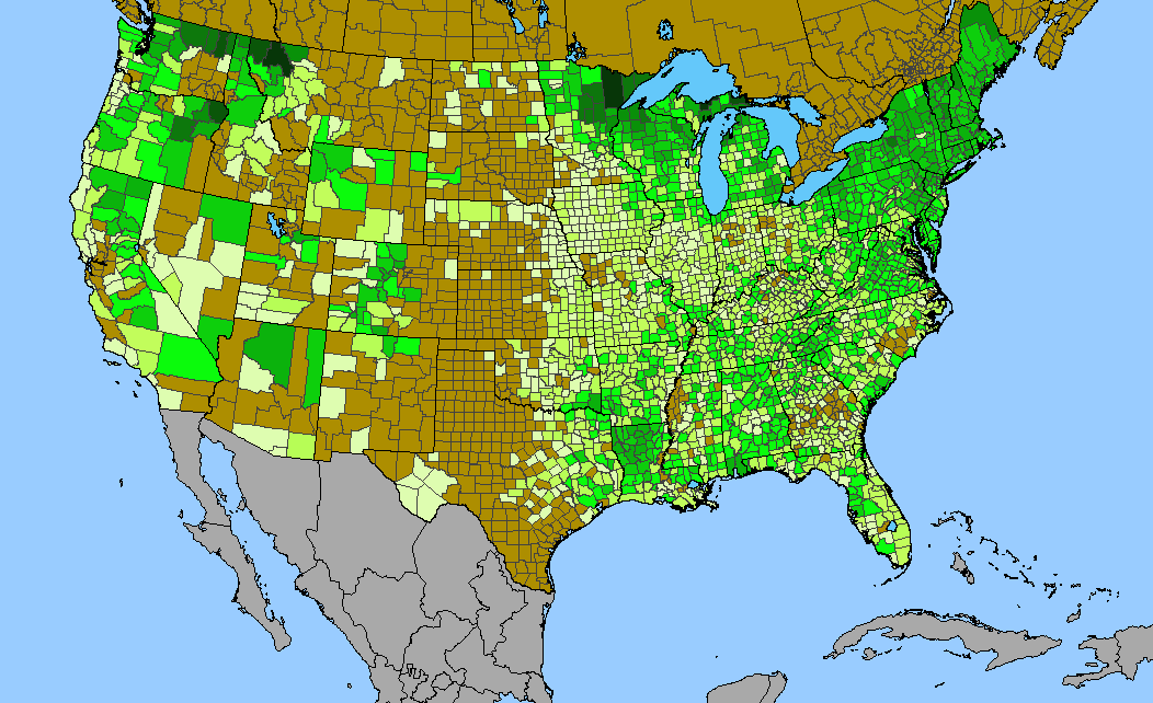
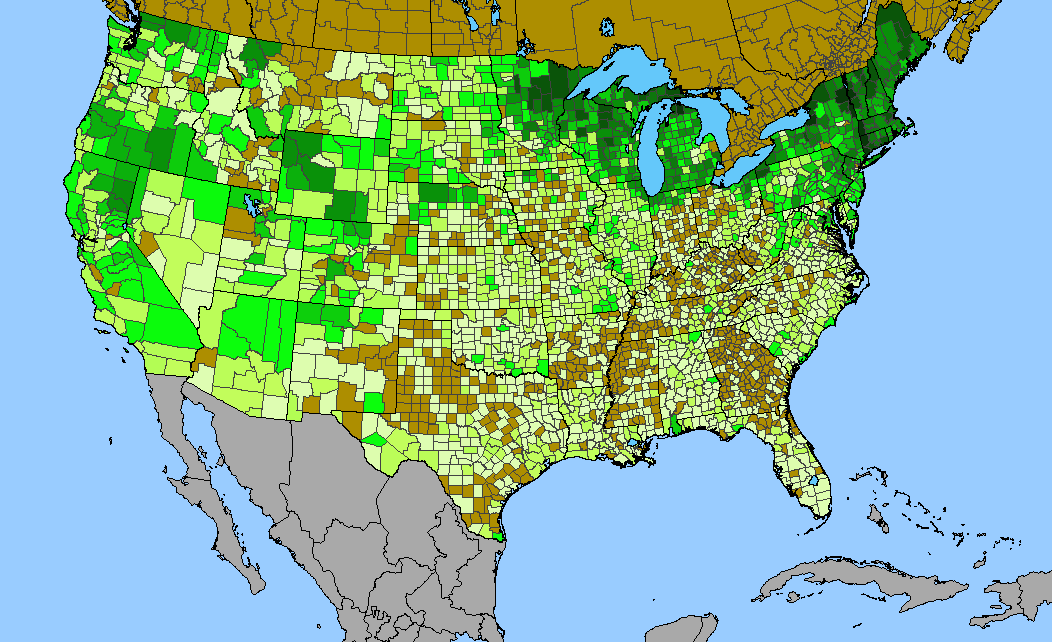
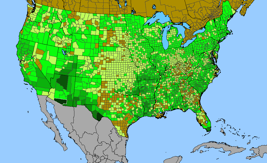
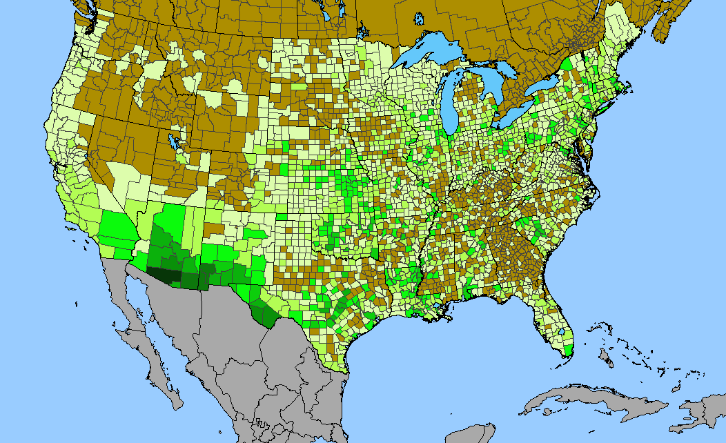
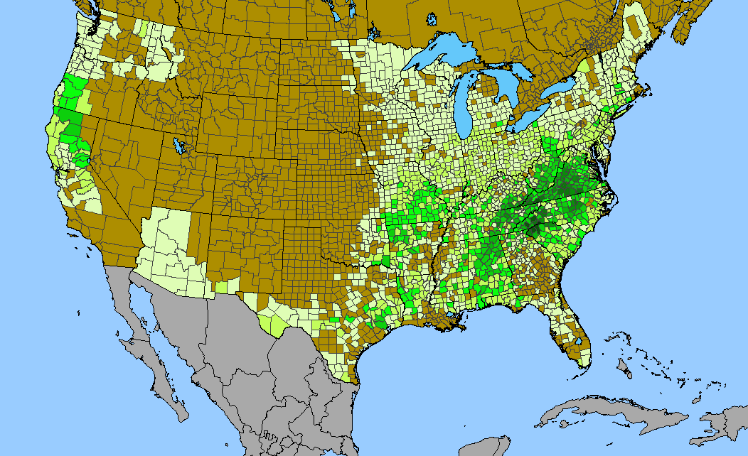
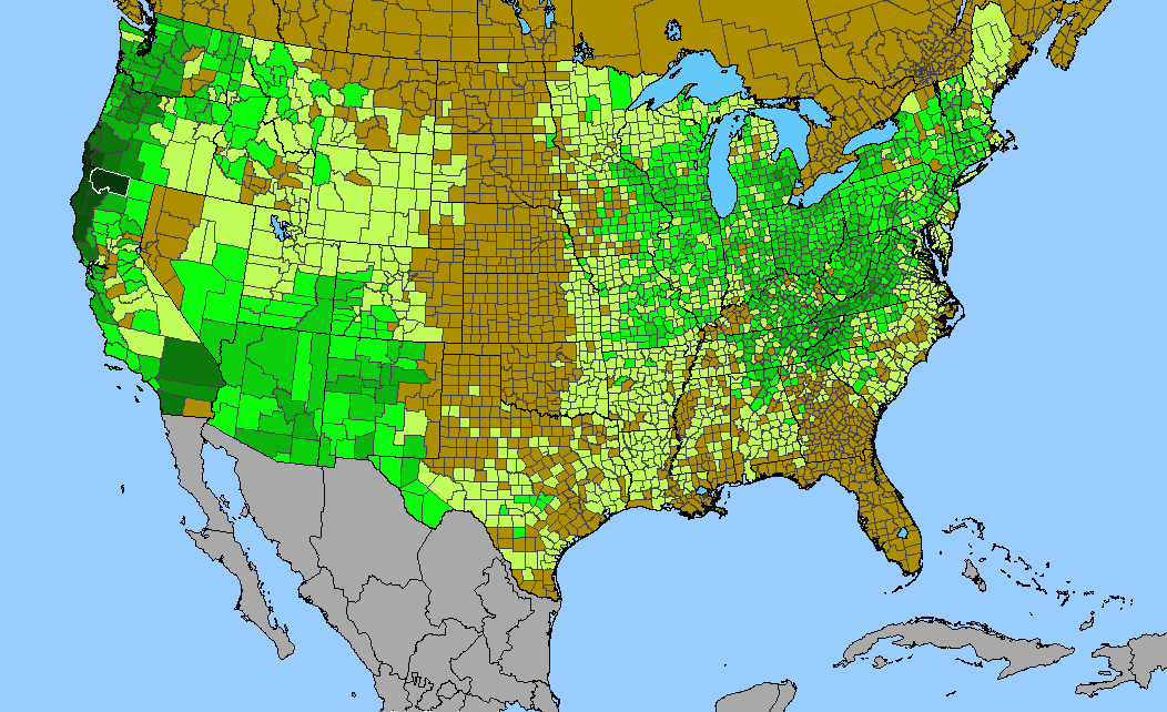
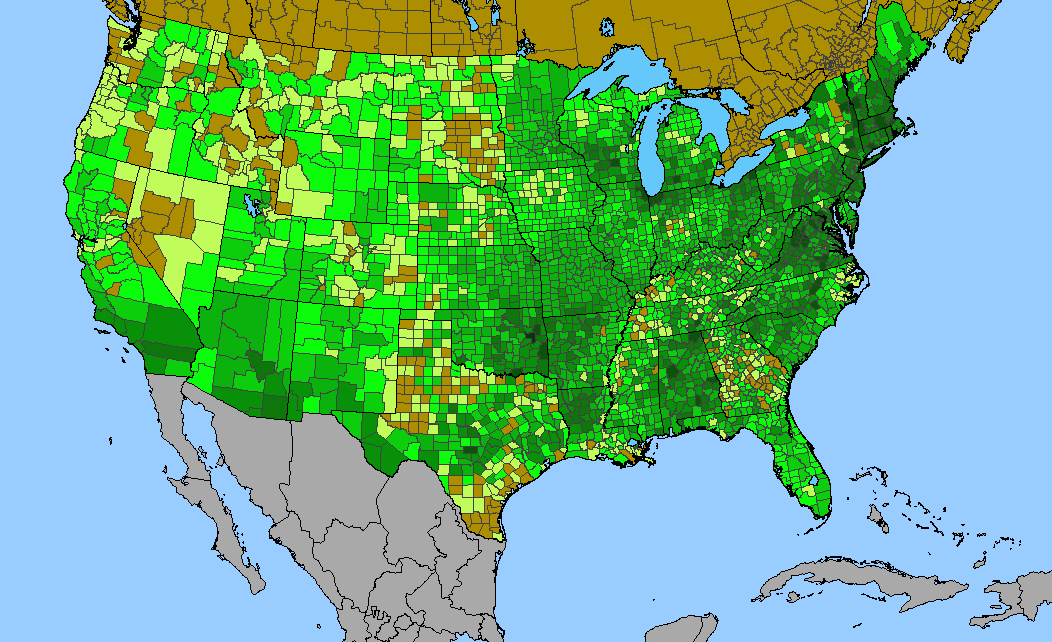
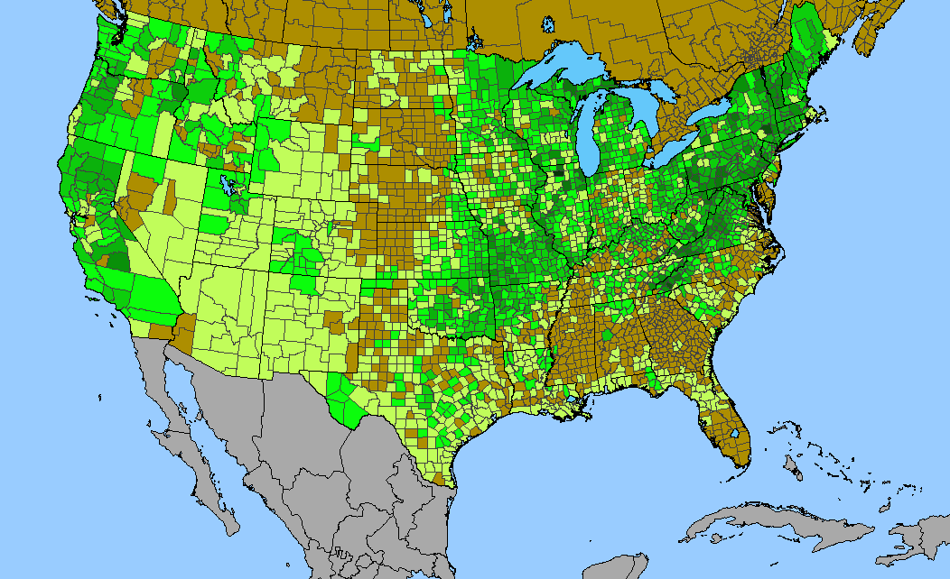
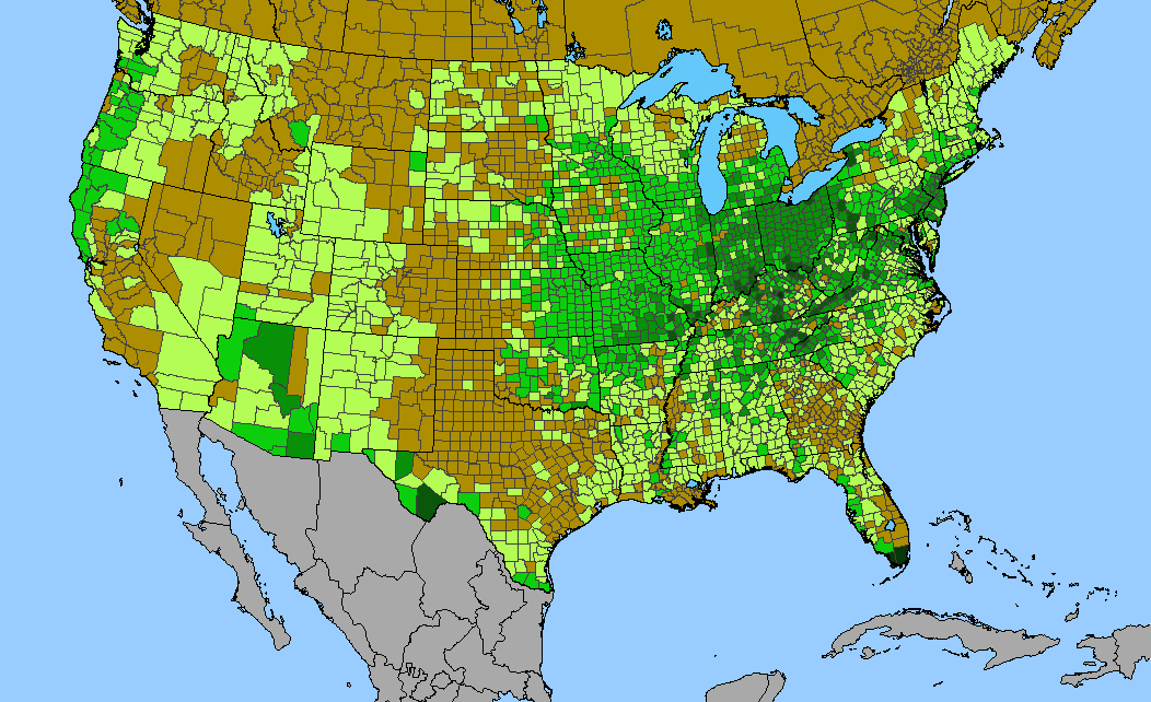
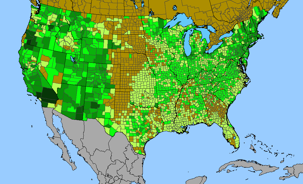
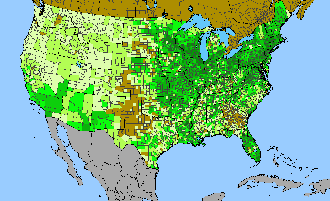
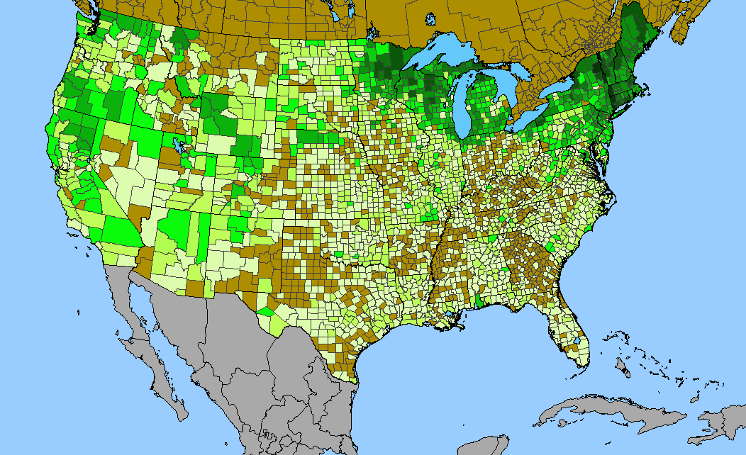
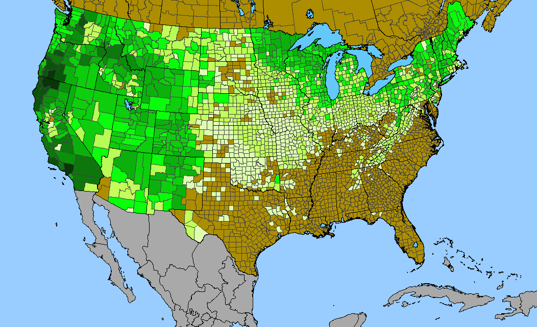
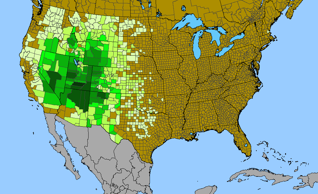
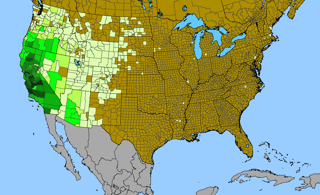
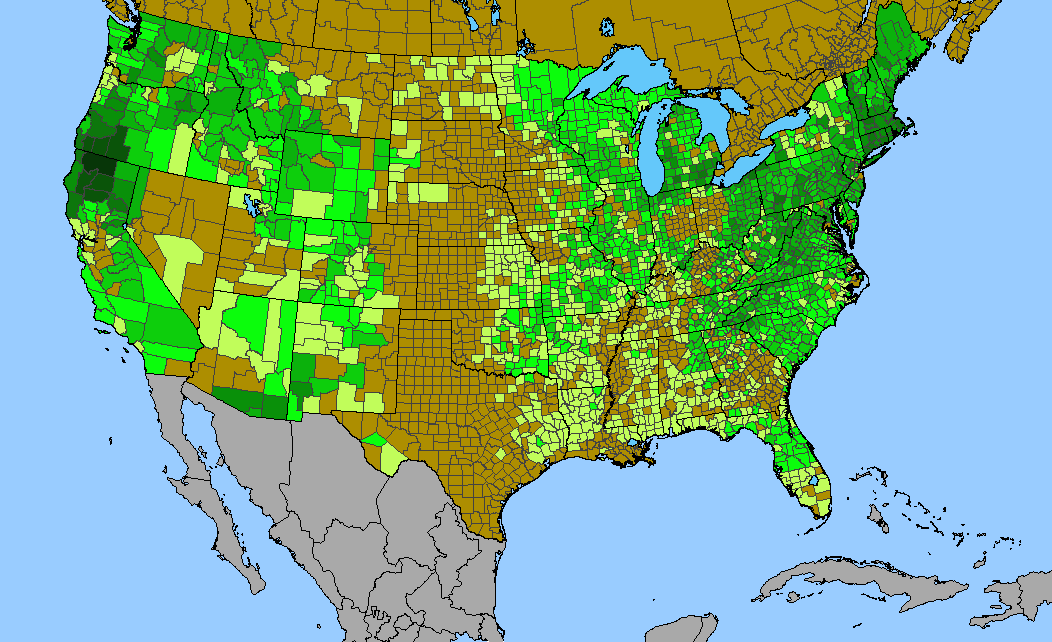
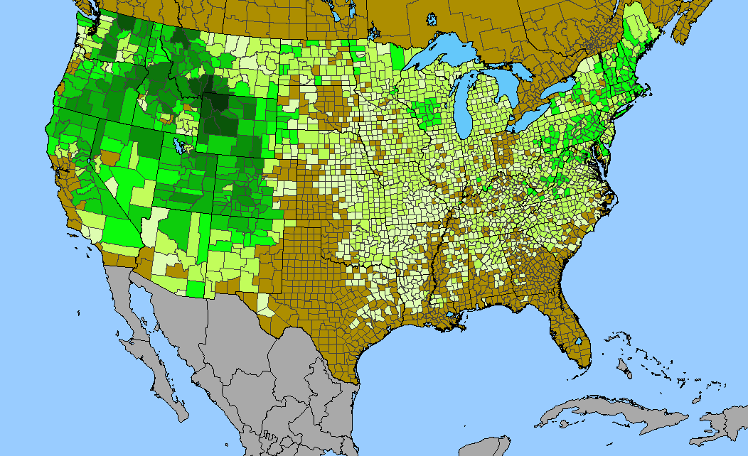
Density gradient of native species for POACEAE within the US (data 2011). Darkest green (221 spp. Coconino County, AZ) indicates the highest species concentration. ©BONAP |
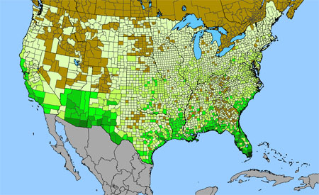
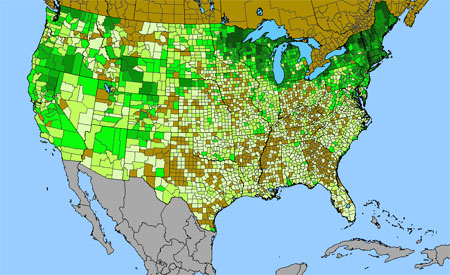
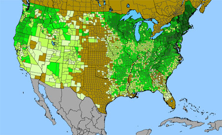
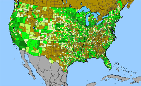
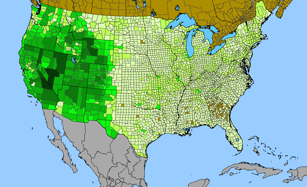
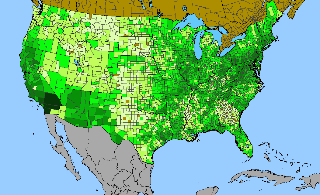
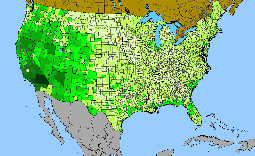
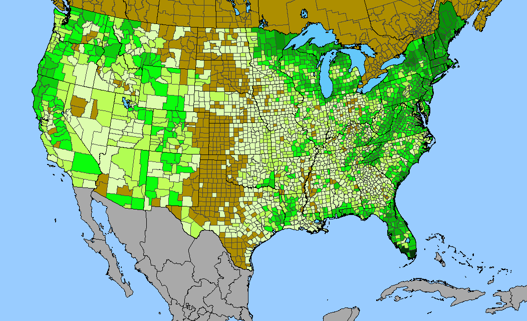
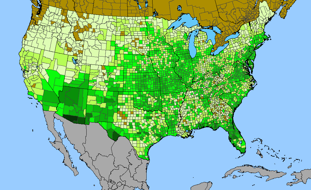
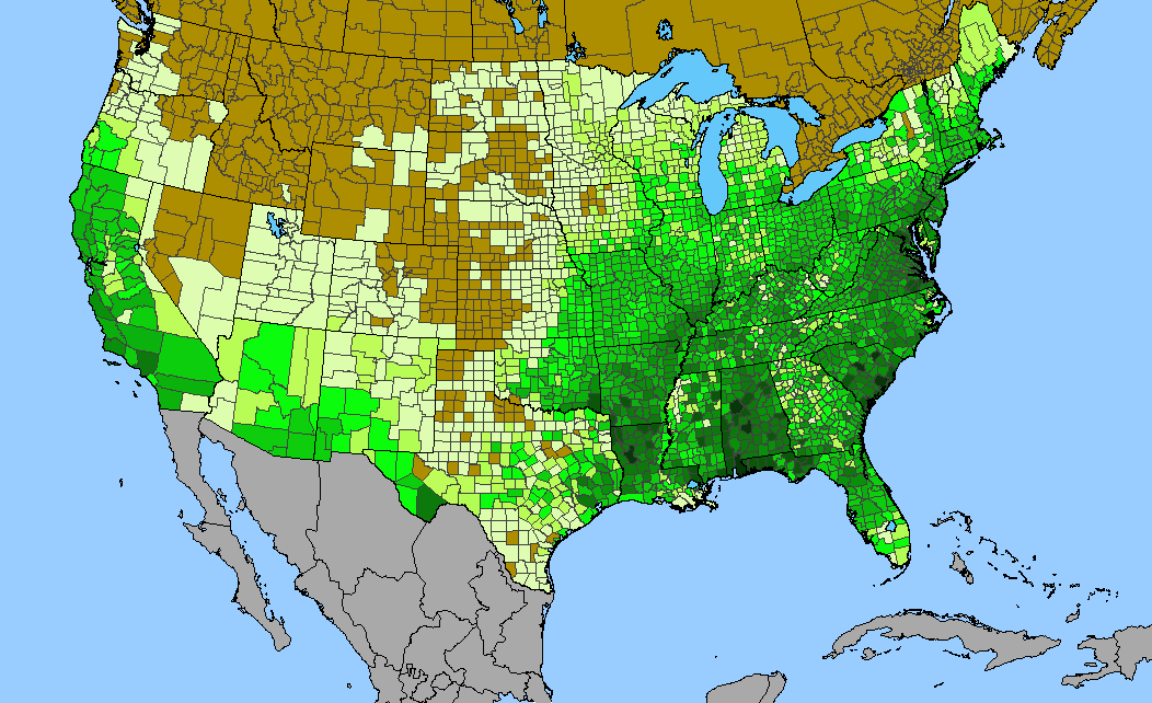
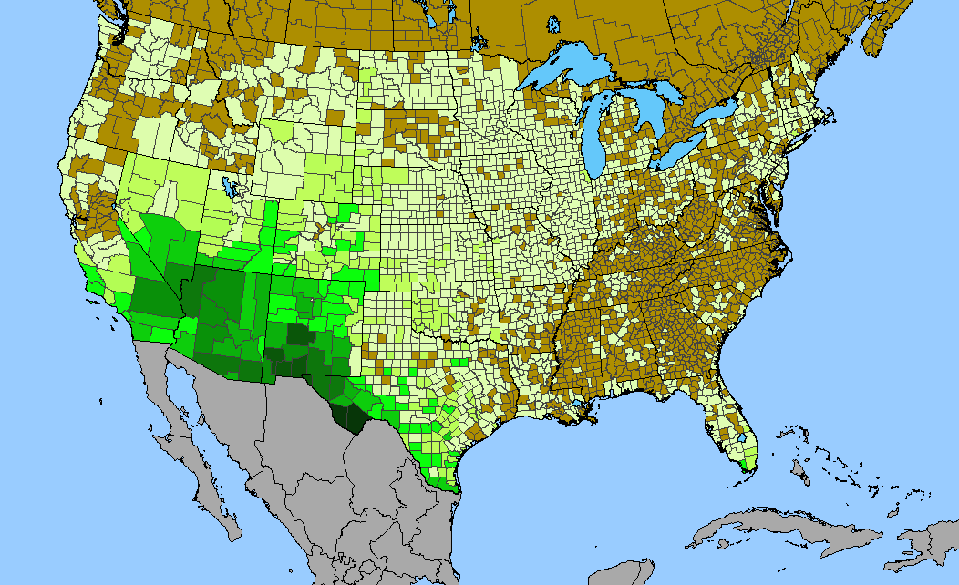
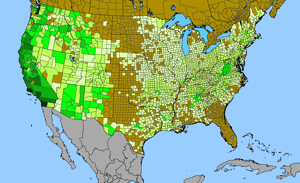
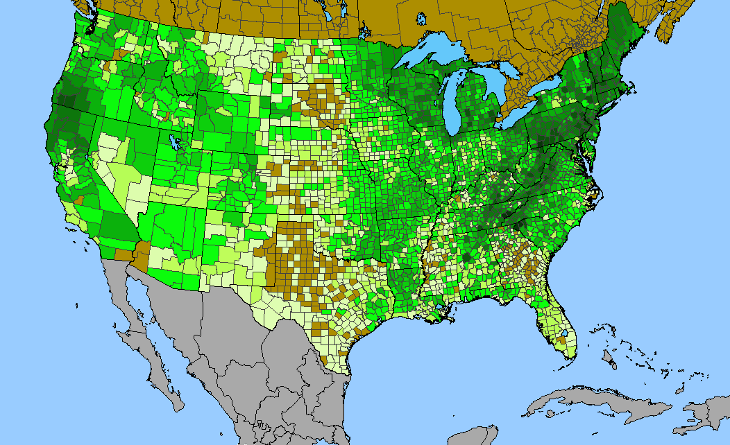
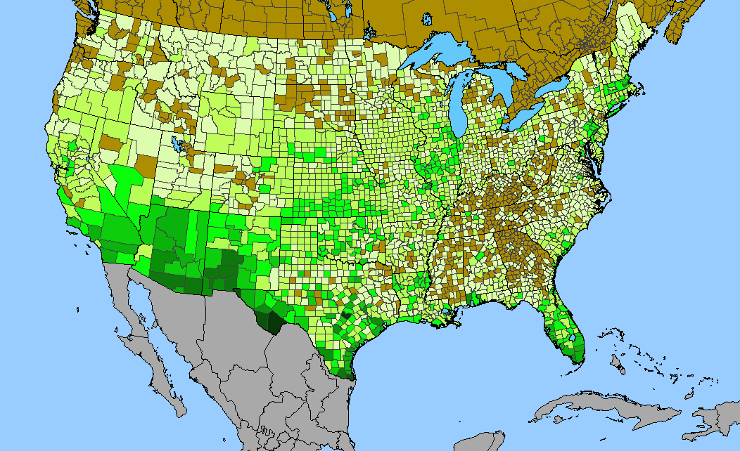
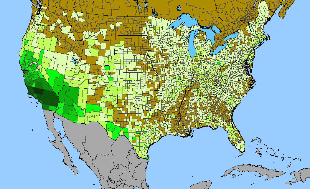
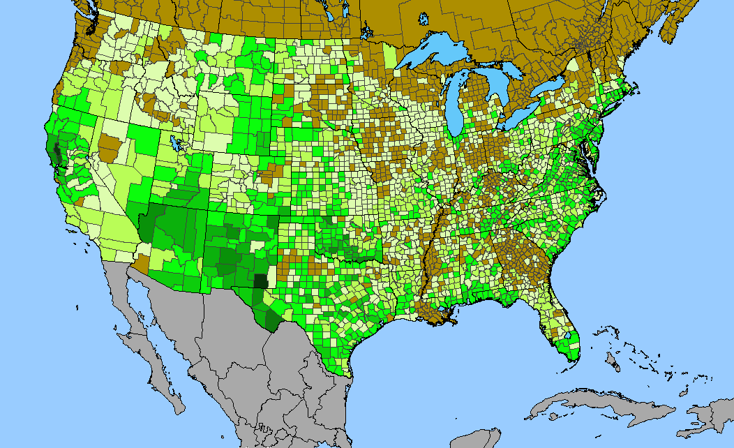
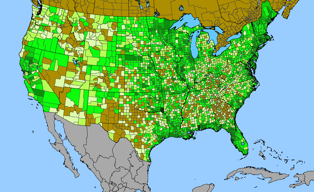
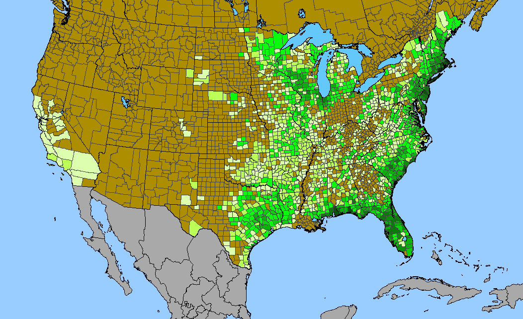
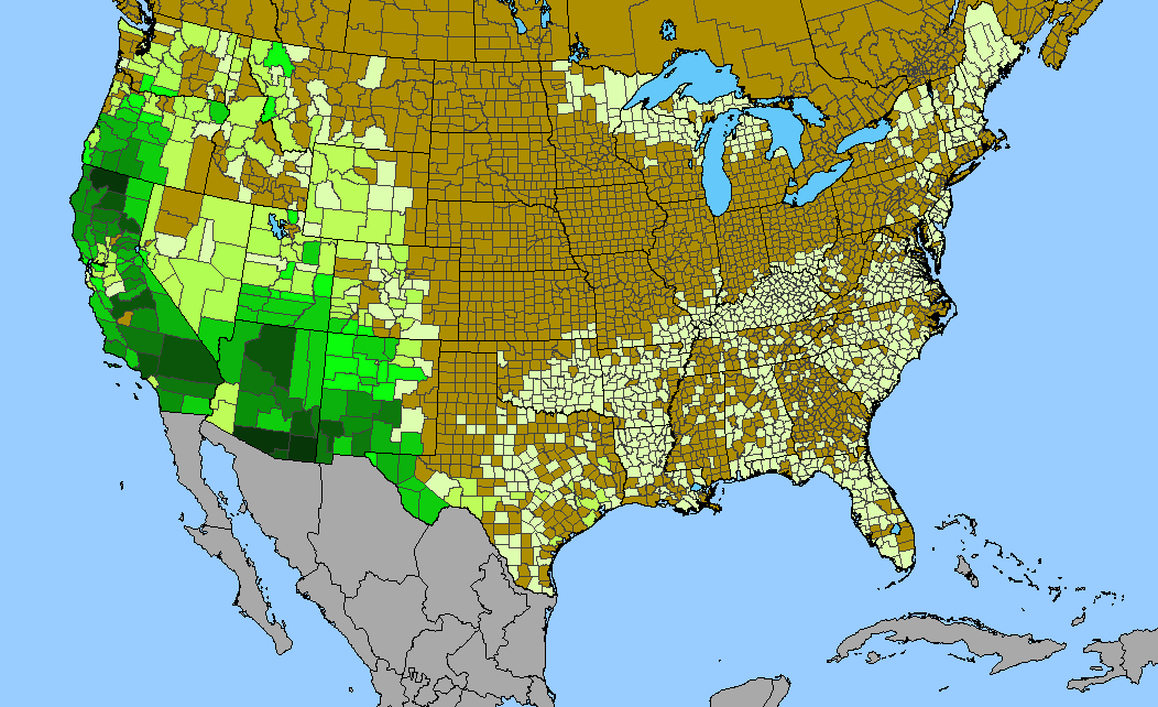
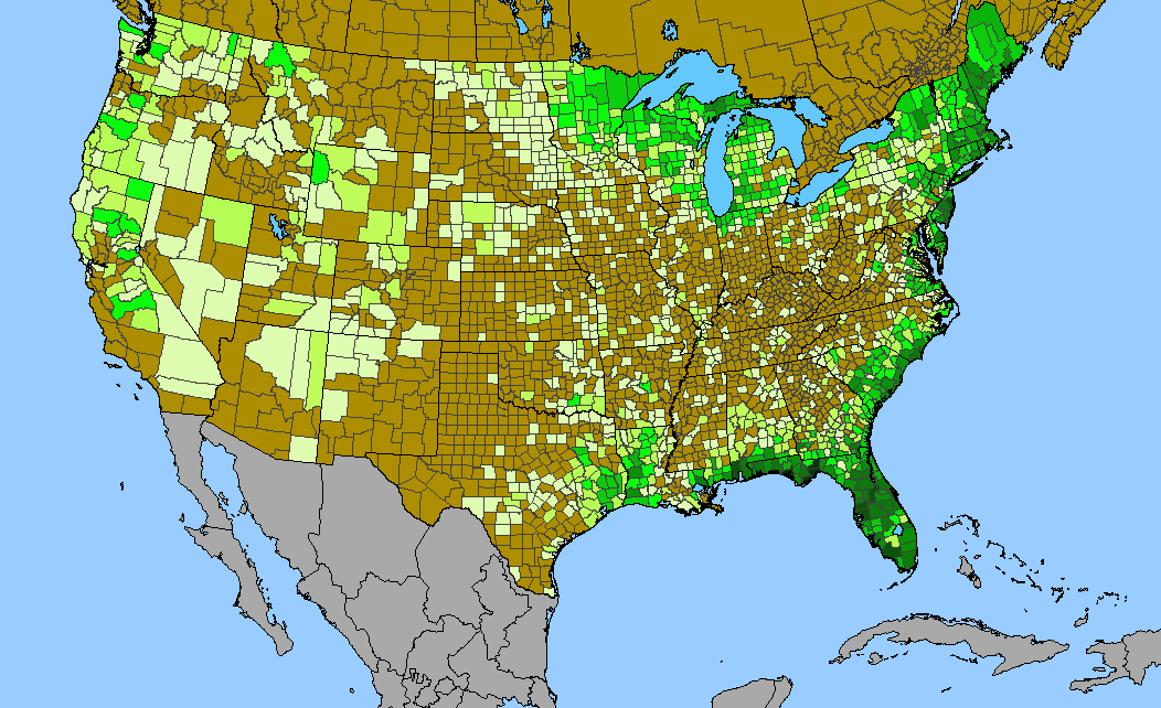
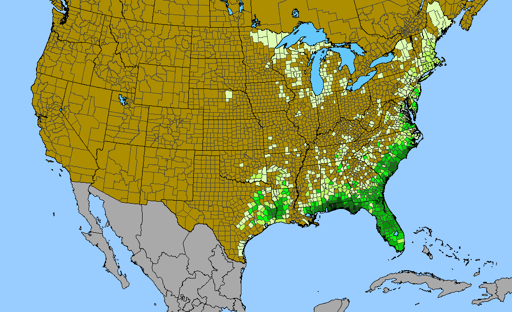
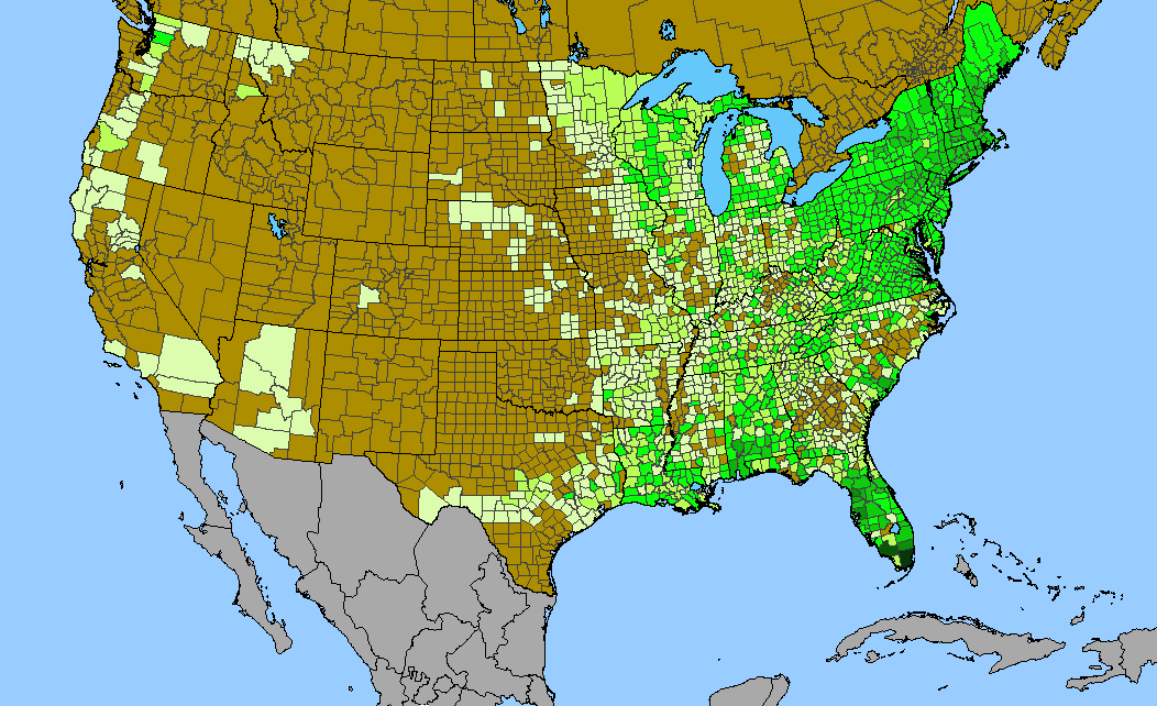
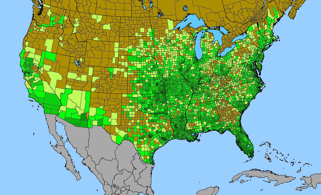
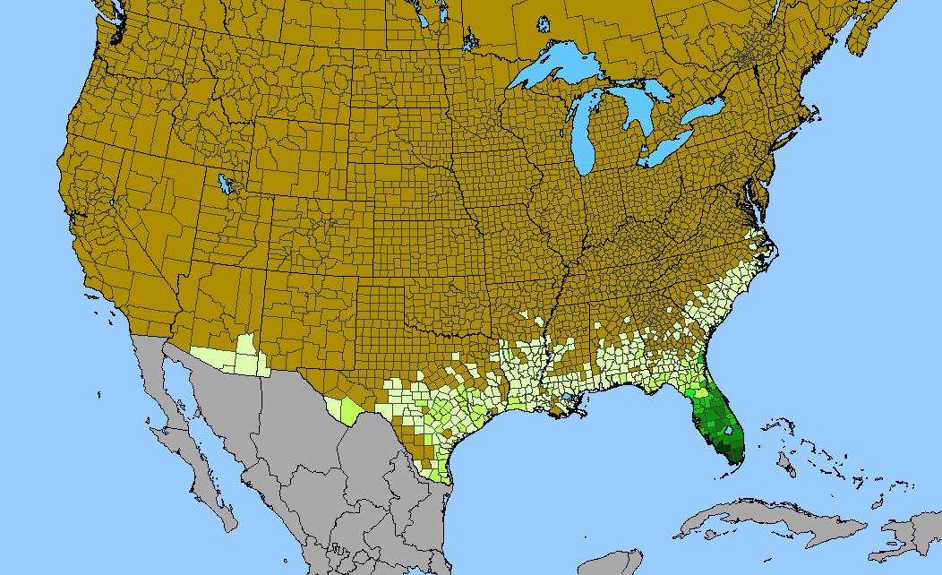
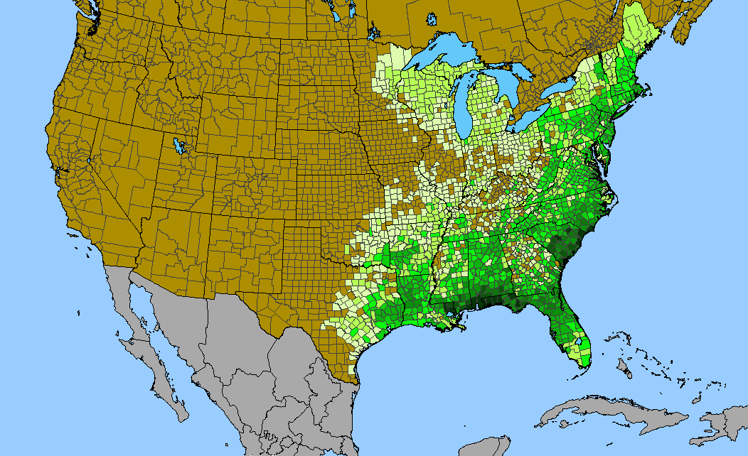
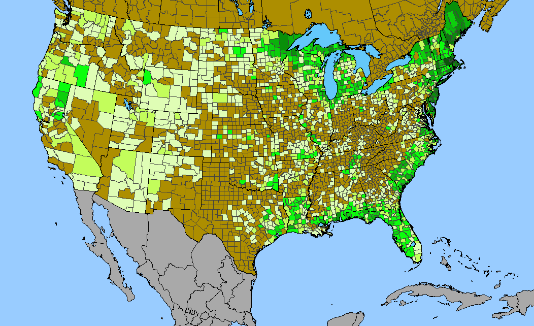
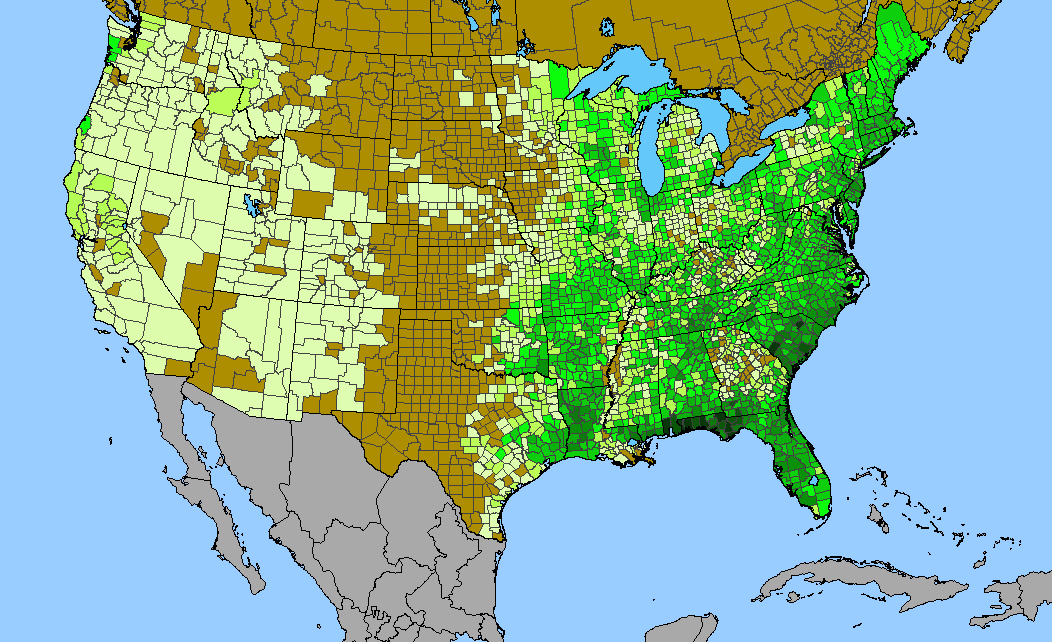
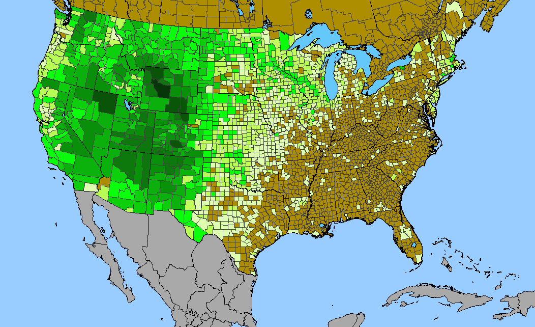
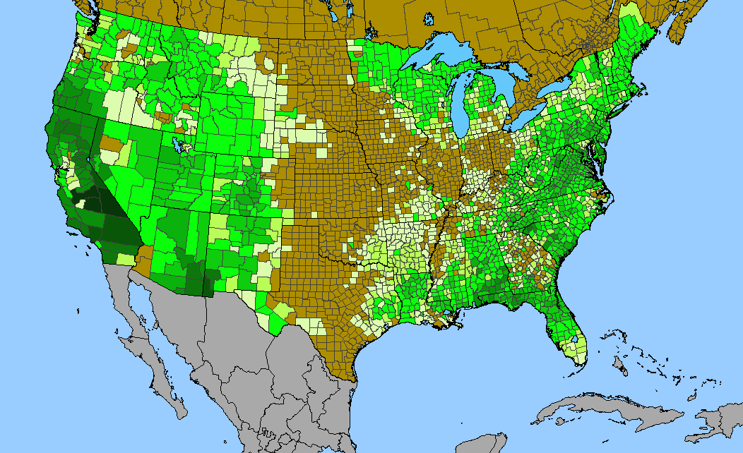
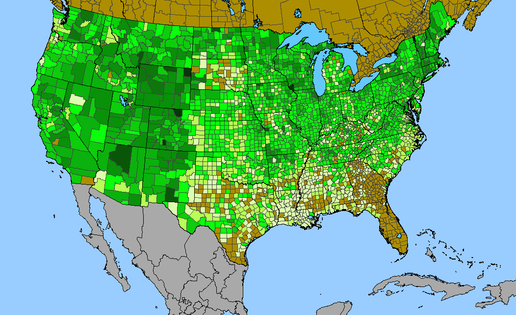
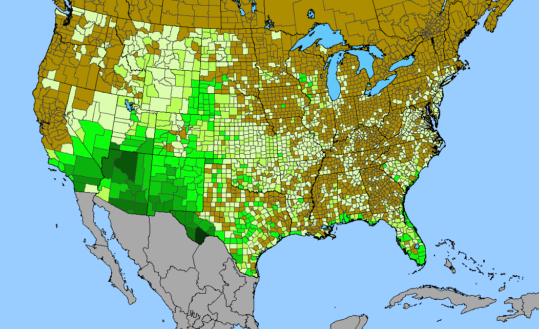
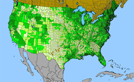 Density gradient of native species for CYPERACEAE within the US (data 2011). Darkest green (181 spp. Suffolk County, NY) indicates the highest species concentration. ©BONAP | 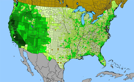
Density gradient of native species for SCROPHULARIACEAE within the US (data 2011). Darkest green (105 spp. San Bernardino County, CA) indicates the highest species concentration. ©BONAP | 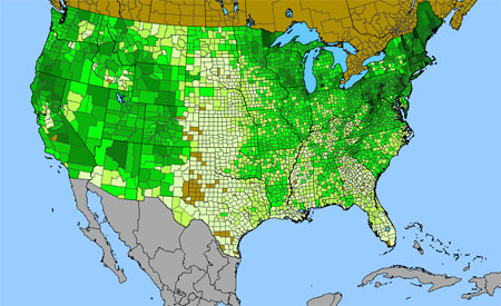
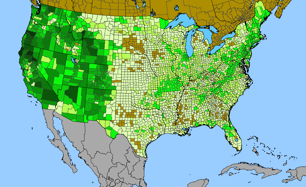
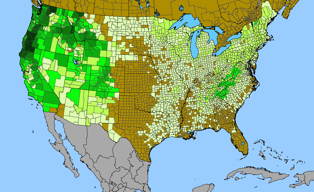
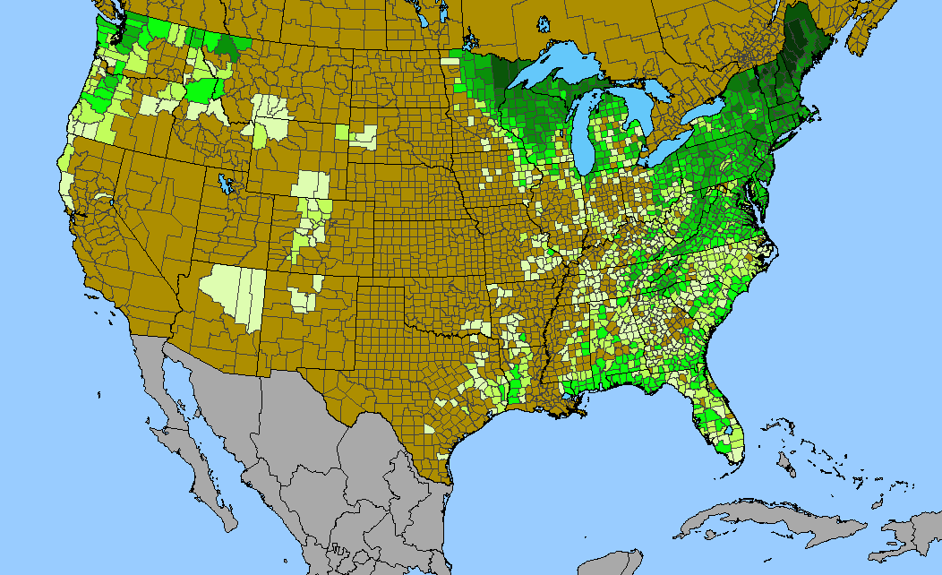
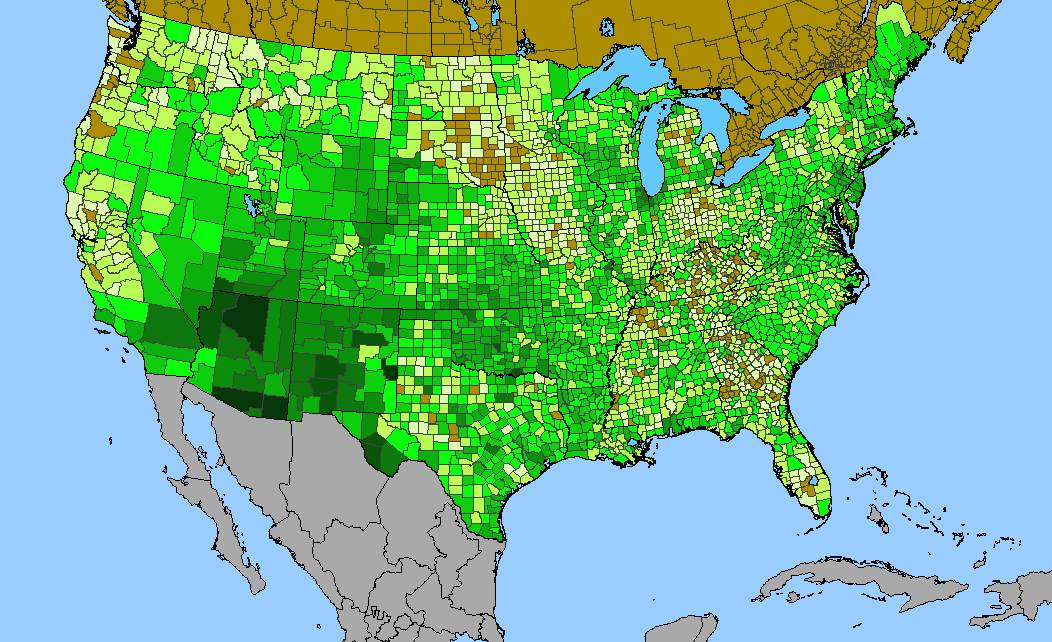
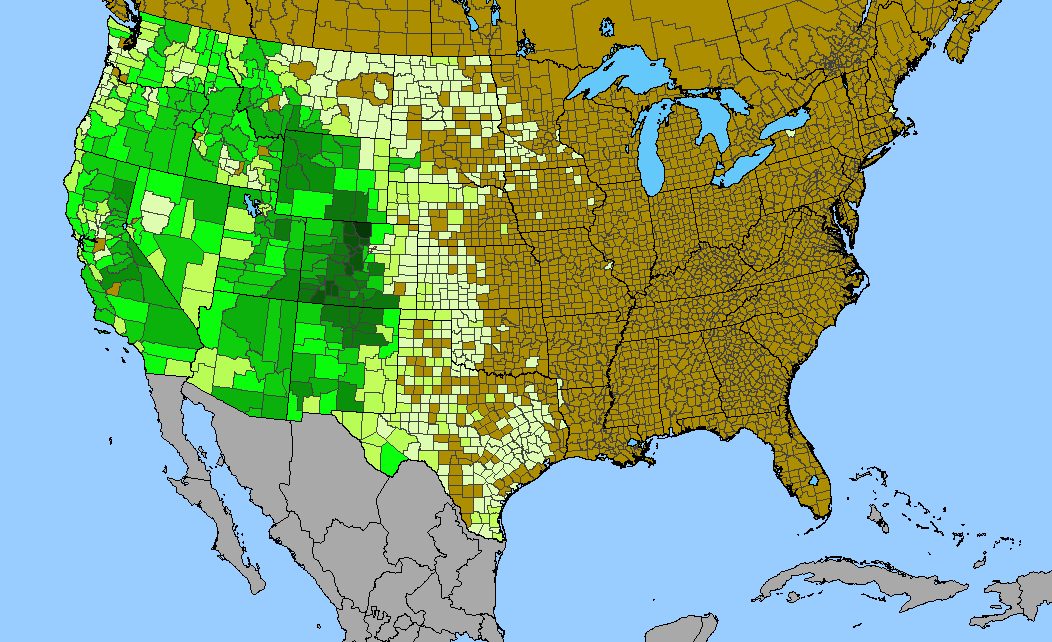
Density gradient of native species for ROSACEAE within the US (data 2011). Darkest green (89 spp. Coos County, NH) indicates the highest species concentration. ©BONAP |
 Density gradient of native species for BRASSICACEAE within the US (data 2011). Darkest green (99 spp. Inyo County, CA) indicates the highest species concentration. ©BONAP | 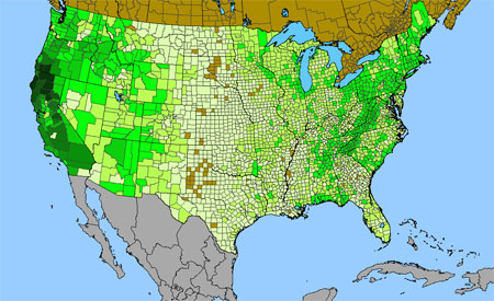 Density gradient of native species for LILIACEAE within the US (data 2011). Darkest green (85 spp. Shasta County, CA) indicates the highest species concentration. ©BONAP | 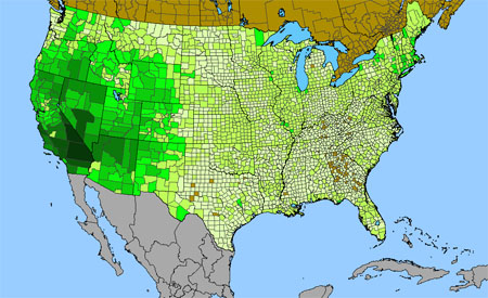
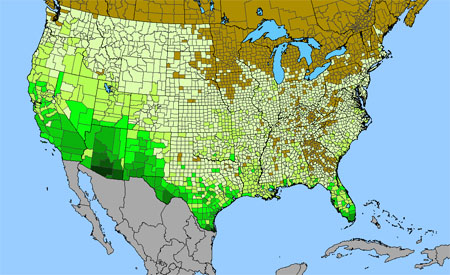
Density gradient of native species for POLYGONACEAE within the US (data 2011). Darkest green (88 spp. Inyo County, CA) indicates the highest species concentration. ©BONAP |
 Density gradient of native species for APIACEAE within the US (data 2011). Darkest green (59 spp. Siskiyou County, CA) indicates the highest species concentration. ©BONAP | 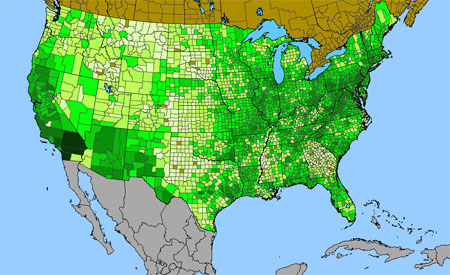 Density gradient of native species for LAMIACEAE within the US (data 2011). Darkest green (50 spp. San Bernardino County, CA) indicates the highest species concentration. ©BONAP | 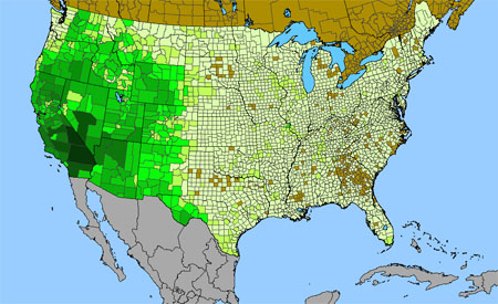 Density gradient of native species for BORAGINACEAE within the US (data 2011). Darkest green (70 spp. Inyo County, CA) indicates the highest species concentration. ©BONAP |
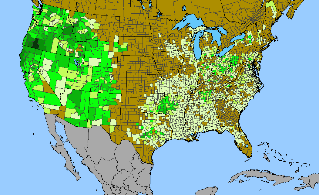
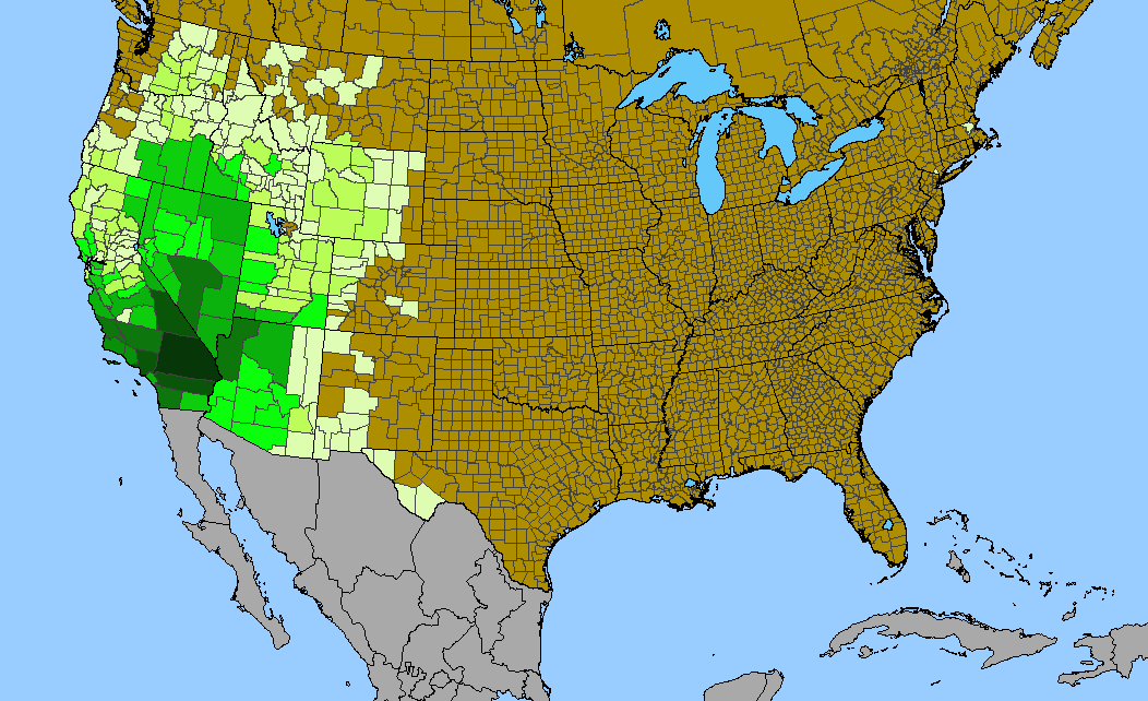
 Density gradient of native species for POLEMONIACEAE within the US (data 2011). Darkest green (94 spp. San Bernardino County, CA) indicates the highest species concentration. ©BONAP |  Density gradient of native species for RANUNCULACEAE within the US (data 2011). Darkest green (55 spp. Park County, WY) indicates the highest species concentration. ©BONAP | 
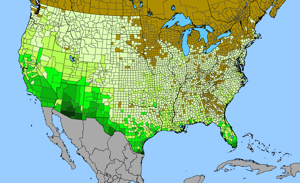
Density gradient of native species for ONAGRACEAE within the US (data 2011). Darkest green (79 spp. San Bernardino County, CA) indicates the highest species concentration. ©BONAP |
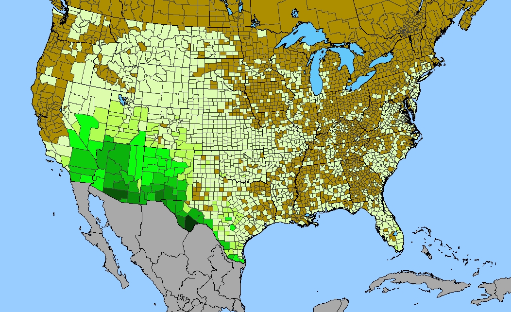
 Density gradient of native species for EUPHORBIACEAE within the US (data 2011). Darkest green (63 spp. Pima County, AZ; Brewster County, TX) indicates the highest species concentration. ©BONAP | 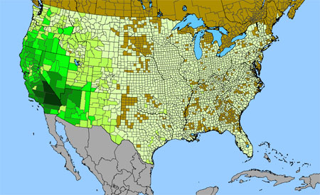 Density gradient of native species for HYDROPHYLLACEAE within the US (data 2011). Darkest green (66 spp. San Bernardino County, CA) indicates the highest species concentration. ©BONAP | 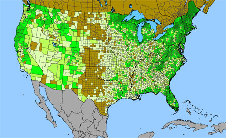 Density gradient of native species for ORCHIDACEAE within the US (data 2011). Darkest green (61 spp. Miami-Dade County, FL) indicates the highest species concentration. ©BONAP |
 Density gradient of native species for CARYOPHYLLACEAE within the US (data 2011). Darkest green (38 spp. Plumas County, CA) indicates the highest species concentration. ©BONAP | 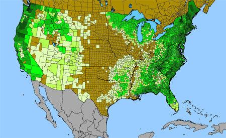 Density gradient of native species for ERICACEAE within the US (data 2011). Darkest green (33 spp. Essex County, NY) indicates the highest species concentration. ©BONAP | 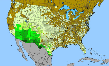 Density gradient of native species for CACTACEAE within the US (data 2011). Darkest green (64 spp. Brewster County, TX) indicates the highest species concentration. ©BONAP |
 Density gradient of native species for MALVACEAE within the US (data 2011). Darkest green (41 spp. Pima County, AZ) indicates the highest species concentration. ©BONAP | 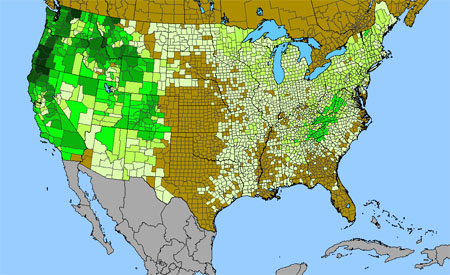 Density gradient of native species for SAXIFRAGACEAE within the US (data 2011). Darkest green (40 spp. Siskiyou County, CA; Jackson County, OR) indicates the highest species concentration. ©BONAP | 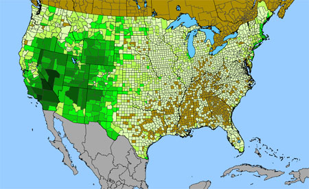 Density gradient of native species for CHENOPODIACEAE within the US (data 2011). Darkest green (52 spp. Los Angeles County, CA) indicates the highest species concentration. ©BONAP |
 Density gradient of native species for RUBIACEAE within the US (data 2011). Darkest green (31 spp. Miami-Dade County, FL) indicates the highest species concentration. ©BONAP | 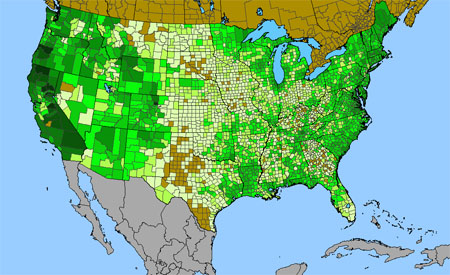 Density gradient of native species for JUNCACEAE within the US (data 2011). Darkest green (37 spp. Plumas County, CA) indicates the highest species concentration. ©BONAP | 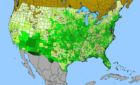 Density gradient of native species for ASCLEPIADACEAE within the US (data 2011). Darkest green (27 spp. Pima County, AZ) indicates the highest species concentration. ©BONAP |
 Density gradient of native species for SOLANACEAE within the US (data 2011). Darkest green (45 spp. Pima County, AZ) indicates the highest species concentration. ©BONAP | 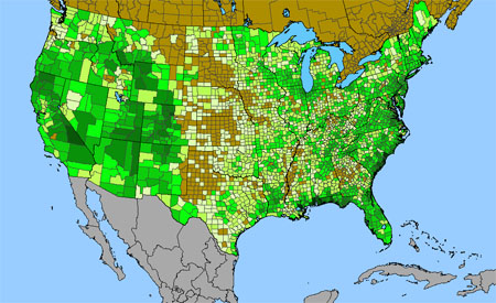 Density gradient of native species for GENTIANACEAE within the US (data 2011). Darkest green (17 spp. Mobile County, AL) indicates the highest species concentration. ©BONAP | 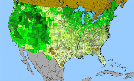 Density gradient of native species for SALICACEAE within the US (data 2011). Darkest green (34 spp. Park County, WY) indicates the highest species concentration. ©BONAP |
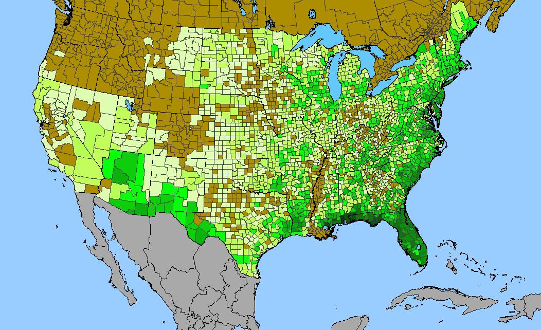
 Density gradient of native species for FAGACEAE within the US (data 2011). Darkest green (28 spp. Berkeley County, SC) indicates the highest species concentration. ©BONAP | 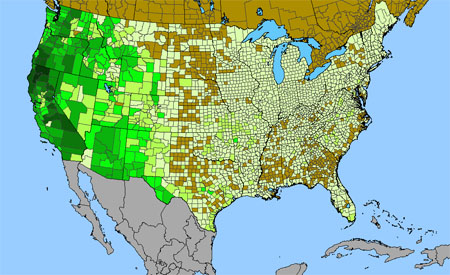 Density gradient of native species for PORTULACACEAE within the US (data 2011). Darkest green (28 spp. Trinity County, CA) indicates the highest species concentration. ©BONAP | 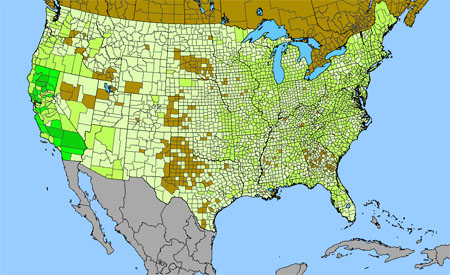 Density gradient of native species for CAMPANULACEAE within the US (data 2011). Darkest green (23 spp. Tehama County, CA) indicates the highest species concentration. ©BONAP |
 Density gradient of native species for CONVOLVULACEAE within the US (data 2011). Darkest green (31 spp. Miami-Dade County, FL) indicates the highest species concentration. ©BONAP |  Density gradient of native species for NYCTAGINACEAE within the US (data 2011). Darkest green (30 spp. Brewster County, TX) indicates the highest species concentration. ©BONAP | 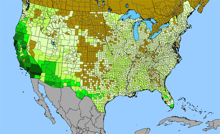 Density gradient of native species for RHAMNACEAE within the US (data 2011). Darkest green (25 spp. Riverside County, CA) indicates the highest species concentration. ©BONAP |
 Density gradient of native species for PTERIDACEAE within the US (data 2011). Darkest green (34 spp. Cochise County, AZ; Brewster County, TX) indicates the highest species concentration. ©BONAP | 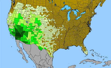 Density gradient of native species for LOASACEAE within the US (data 2011). Darkest green (28 spp. San Bernardino County, CA) indicates the highest species concentration. ©BONAP | 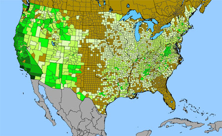 Density gradient of native species for CRASSULACEAE within the US (data 2011). Darkest green (17 spp. Santa Barbara County, CA) indicates the highest species concentration. ©BONAP |
 Density gradient of native species for DRYOPTERIDACEAE within the US (data 2011). Darkest green (26 spp. Marquette County, MI) indicates the highest species concentration. ©BONAP |  Density gradient of native species for VERBENACEAE within the US (data 2011). Darkest green (28 spp. Cameron County, TX; Hidalgo County, TX) indicates the highest species concentration. ©BONAP | 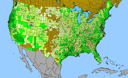 Density gradient of native species for IRIDACEAE within the US (data 2011). Darkest green (15 spp. Natchitoches Parish, LA) indicates the highest species concentration. ©BONAP |
 Density gradient of native species for VIOLACEAE within the US (data 2011). Darkest green (22 spp. Blount County, TN; Sevier County, TN) indicates the highest species concentration. ©BONAP | 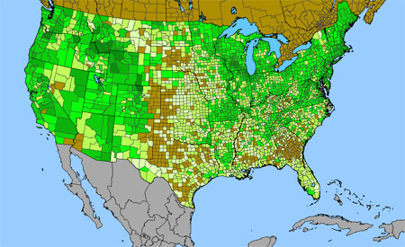 Density gradient of native species for PRIMULACEAE within the US (data 2011). Darkest green (12 spp. Larimer County, CO) indicates the highest species concentration. ©BONAP | 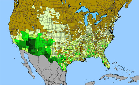 Density gradient of native species for AGAVACEAE within the US (data 2011). Darkest green (14 spp. Maricopa County, AZ; Yavapai County, AZ) indicates the highest species concentration. ©BONAP |
 Density gradient of native species for PINACEAE within the US (data 2011). Darkest green (19 spp. Jackson County, OR) indicates the highest species concentration. (traditional usage) ©BONAP |  Density gradient of native species for AMARANTHACEAE within the US (data 2011). Darkest green (23 spp. Brewster County, TX) indicates the highest species concentration. ©BONAP |  Density gradient of native species for ACANTHACEAE within the US (data 2011). Darkest green (18 spp. Brewster County, TX) indicates the highest species concentration. ©BONAP |
 Density gradient of native species for CLUSIACEAE within the US (data 2011). Darkest green (23 spp. Franklin County, FL) indicates the highest species concentration. ©BONAP | 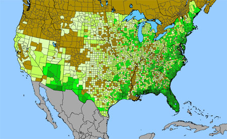 Density gradient of native species for POLYGALACEAE within the US (data 2011). Darkest green (17 spp. Mobile County, AL) indicates the highest species concentration. ©BONAP | 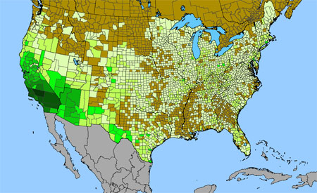 Density gradient of native species for PAPAVERACEAE within the US (data 2011). Darkest green (17 spp. Kern County, CA) indicates the highest species concentration. ©BONAP |
 Density gradient of native species for CAPRIFOLIACEAE within the US (data 2011). Darkest green (21 spp. Essex County, NY) indicates the highest species concentration. ©BONAP | 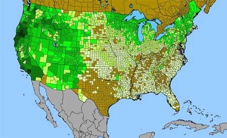 Density gradient of native species for GROSSULARIACEAE within the US (data 2011). Darkest green (17 spp. Los Angeles County, CA) indicates the highest species concentration. ©BONAP | 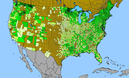 Density gradient of native species for OPHIOGLOSSACEAE within the US (data 2011). Darkest green (17 spp. St. Louis County, MN; Flathead County, MT) indicates the highest species concentration. ©BONAP |
 Density gradient of native species for LINACEAE within the US (data 2011). Darkest green (11 spp. Eddy County, NM) indicates the highest species concentration. ©BONAP | 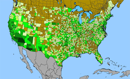 Density gradient of native species for CUSCUTACEAE within the US (data 2011). Darkest green (12 spp. Pima County, AZ) indicates the highest species concentration. ©BONAP | 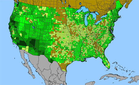 Density gradient of native species for CUPRESSACEAE within the US (data 2011). Darkest green (8 spp. Coconino County, AZ; Los Angeles County, CA; Mendocino County, CA; Plumas County, CA; San Bernardino County, CA; Siskiyou County, CA) indicates the highest species concentration. ©BONAP |
 Density gradient of native species for POTAMOGETONACEAE within the US (data 2011). Darkest green (25 spp. Berkshire County, MA; Washington County, NY) indicates the highest species concentration. ©BONAP | 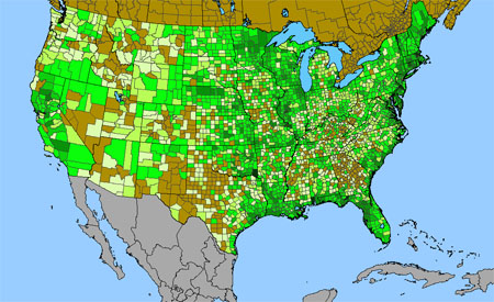 Density gradient of native species for ALISMATACEAE within the US (data 2011). Darkest green (12 spp. Mobile County, AL; Leon County, FL) indicates the highest species concentration. ©BONAP | 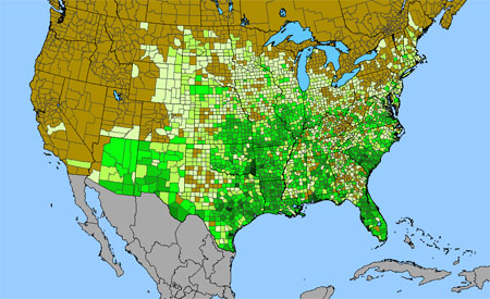 Density gradient of native species for COMMELINACEAE within the US (data 2011). Darkest green (11 spp. Travis County, TX) indicates the highest species concentration. ©BONAP |
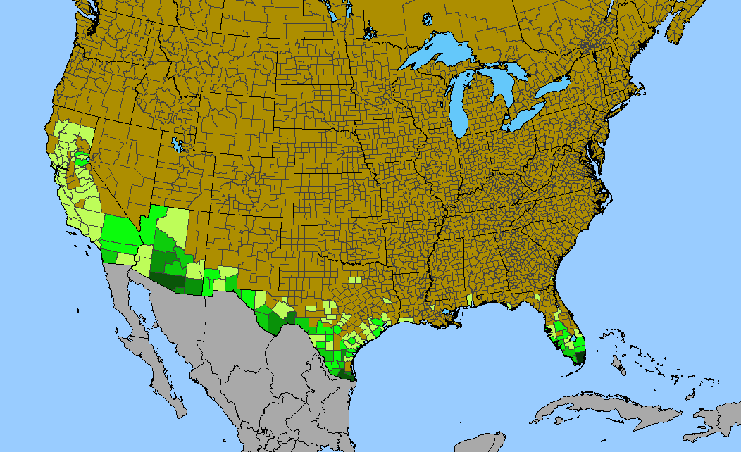
 Density gradient of native species for ISOETACEAE within the US (data 2011). Darkest green (6 spp. Aroostook County, ME) indicates the highest species concentration. ©BONAP |  Density gradient of native species for SELAGINELLACEAE within the US (data 2011). Darkest green (10 spp. Brewster County, TX) indicates the highest species concentration. ©BONAP | 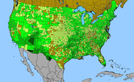 Density gradient of native species for APOCYNACEAE within the US (data 2011). Darkest green (8 spp. Pima County, AZ; Brewster County, TX) indicates the highest species concentration. ©BONAP |
 Density gradient of native species for CISTACEAE within the US (data 2011). Darkest green (13 spp. Nassau County, NY; Suffolk County, NY) indicates the highest species concentration. ©BONAP | 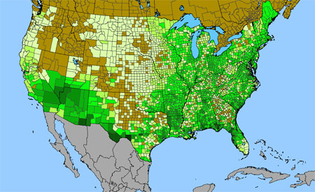 Density gradient of native species for OLEACEAE within the US (data 2011). Darkest green (9 spp. Val Verde County, TX) indicates the highest species concentration. ©BONAP | 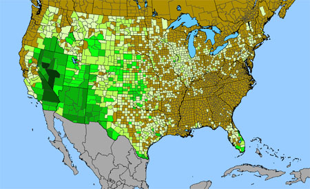 Density gradient of native species for CAPPARACEAE within the US (data 2011). Darkest green (11 spp. Nye County, NV) indicates the highest species concentration. ©BONAP |
 Density gradient of native species for CUCURBITACEAE within the US (data 2011). Darkest green (10 spp. Pima County, AZ) indicates the highest species concentration. ©BONAP | 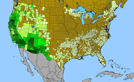 Density gradient of native species for VISCACEAE within the US (data 2011). Darkest green (14 spp. Cochise County, AZ; Pima County, AZ) indicates the highest species concentration. ©BONAP | 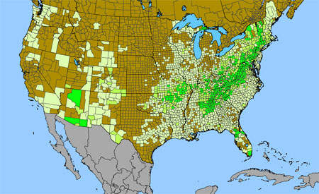 Density gradient of native species for ASPLENIACEAE within the US (data 2011). Darkest green (11 spp. Jackson County, AL) indicates the highest species concentration. ©BONAP |
 Density gradient of native species for LENTIBULARIACEAE within the US (data 2011). Darkest green (16 spp. Bay County, FL; Franklin County, FL) indicates the highest species concentration. ©BONAP | 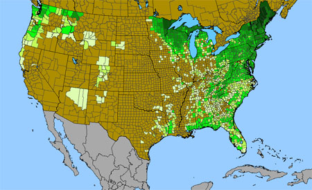 Density gradient of native species for LYCOPODIACEAE within the US (data 2011). Darkest green (17 spp. Franklin County, ME) indicates the highest species concentration. ©BONAP |  Density gradient of native species for VALERIANACEAE within the US (data 2011). Darkest green (9 spp. Klamath County, OR) indicates the highest species concentration. ©BONAP |
 Density gradient of native species for BETULACEAE within the US (data 2011). Darkest green (14 spp. Essex County, NY) indicates the highest species concentration. ©BONAP | 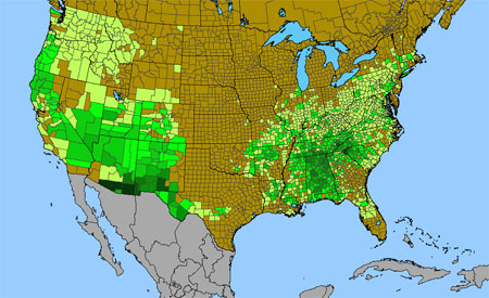 Density gradient of native species for HYDRANGEACEAE within the US (data 2011). Darkest green (8 spp. Cochise County, AZ; Pima County, AZ) indicates the highest species concentration. ©BONAP | 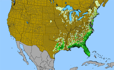 Density gradient of native species for XYRIDACEAE within the US (data 2011). Darkest green (20 spp. Bay County, FL; Liberty County, FL) indicates the highest species concentration. ©BONAP |
 Density gradient of native species for ARISTOLOCHIACEAE within the US (data 2011). Darkest green (9 spp. Polk County, NC) indicates the highest species concentration. ©BONAP | 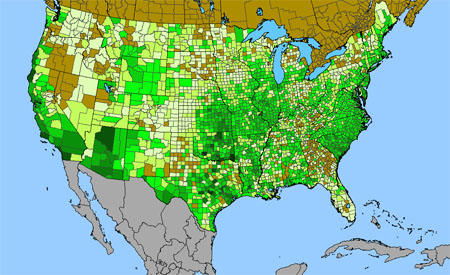 Density gradient of native species for PLANTAGINACEAE within the US (data 2011). Darkest green (9 spp. Comanche County, OK; McCurtain County, OK; Travis County, TX) indicates the highest species concentration. ©BONAP | 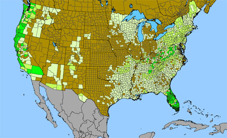 Density gradient of native species for POLYPODIACEAE within the US (data 2011). Darkest green (9 spp. Miami-Dade County, FL) indicates the highest species concentration. ©BONAP |
 Density gradient of native species for BERBERIDACEAE within the US (data 2011). Darkest green (8 spp. Del Norte County, CA; Siskiyou County, CA; Curry County, OR) indicates the highest species concentration. ©BONAP | 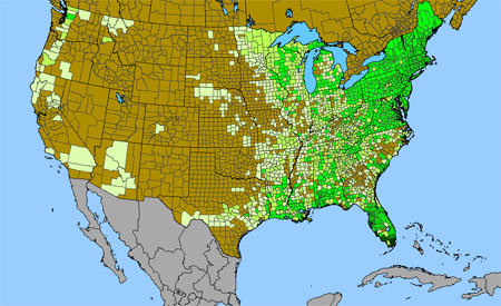 Density gradient of native species for THELYPTERIDACEAE within the US (data 2011). Darkest green (12 spp. Miami-Dade County, FL) indicates the highest species concentration. ©BONAP | 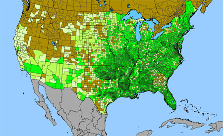 Density gradient of native species for VITACEAE within the US (data 2011). Darkest green (12 spp. Johnston County, OK) indicates the highest species concentration. ©BONAP | |
 Density gradient of native species for ANACARDIACEAE within the US (data 2011). Darkest green (8 spp. Muskogee County, OK) indicates the highest species concentration. ©BONAP | 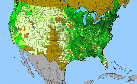 Density gradient of native species for CORNACEAE within the US (data 2011). Darkest green (10 spp. Erie County, NY) indicates the highest species concentration. ©BONAP | 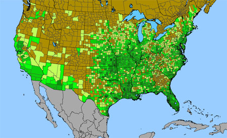 Density gradient of native species for LYTHRACEAE within the US (data 2011). Darkest green (8 spp. Franklin County, FL) indicates the highest species concentration. ©BONAP | |
 Density gradient of native species for OXALIDACEAE within the US (data 2011). Darkest green (8 spp. Cochise County, AZ; Grant County, NM) indicates the highest species concentration. ©BONAP |  Density gradient of native species for SMILACACEAE within the US (data 2011). Darkest green (12 spp. Leon County, FL; Charleston County, SC; Georgetown County, SC; Orangeburg County, SC) indicates the highest species concentration. ©BONAP | 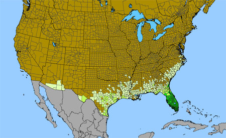 Density gradient of native species for BROMELIACEAE within the US (data 2011). Darkest green (14 spp. Collier County, FL) indicates the highest species concentration. ©BONAP | |
 Density gradient of native species for FUMARIACEAE within the US (data 2011). Darkest green (8 spp. Ogle County, IL) indicates the highest species concentration. ©BONAP | 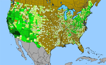 Density gradient of native species for OROBANCHACEAE within the US (data 2011). Darkest green (9 spp. Los Angeles County, CA; Mendocino County, CA; San Bernardino County, CA) indicates the highest species concentration. ©BONAP | 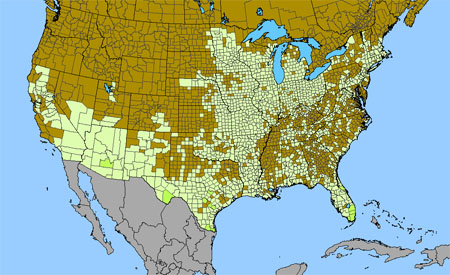 Density gradient of native species for RUTACEAE within the US (data 2011). Darkest green (6 spp. Cameron County, TX) indicates the highest species concentration. ©BONAP | |
 Density gradient of native species for STERCULIACEAE within the US (data 2011). Darkest green (7 spp. Miami-Dade County, FL) indicates the highest species concentration. ©BONAP | 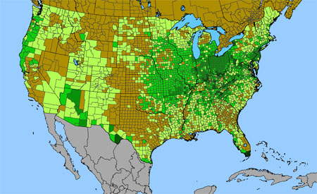 Density gradient of native species for CELASTRACEAE within the US (data 2011). Darkest green (5 spp. Miami-Dade County, FL; Monroe County, FL; Madison County, KY) indicates the highest species concentration. ©BONAP | 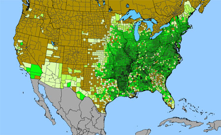 Density gradient of native species for JUGLANDACEAE within the US (data 2011). Darkest green (11 spp. Poinsett County, AR; Jackson County, IL; Scott County, MO) indicates the highest species concentration. ©BONAP | |
 Density gradient of native species for LEMNACEAE within the US (data 2011). Darkest green (13 spp. Butte County, CA) indicates the highest species concentration. ©BONAP | 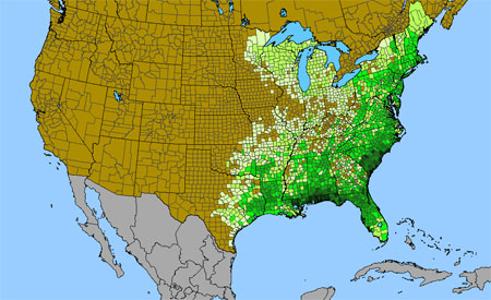 Density gradient of native species for AQUIFOLIACEAE within the US (data 2011). Darkest green (11 spp. Mobile County, AL; Santa Rosa County, FL; St. Tammany Parish County, LA; Brunswick County, NC; Darlington County, SC; Georgetown County, SC; Horry County, SC) indicates the highest species concentration. ©BONAP | 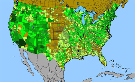 Density gradient of native species for GERANIACEAE within the US (data 2011). Darkest green (6 spp. Los Angeles County, CA; Riverside County, CA; San Bernardino County, CA; Jackson County, OR) indicates the highest species concentration. ©BONAP | |
 Density gradient of native species for ERIOCAULACEAE within the US (data 2011). Darkest green (11 spp. Bay County, FL) indicates the highest species concentration. ©BONAP | 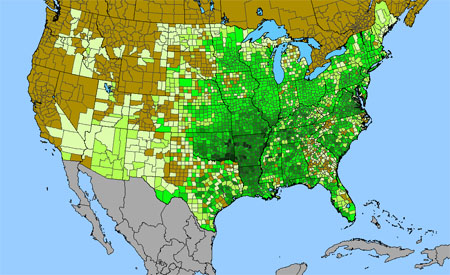 Density gradient of native species for ULMACEAE within the US (data 2011). Darkest green (10 spp. McCurtain County, OK; Pushmataha County, OK) indicates the highest species concentration. ©BONAP |  Density gradient of native species for URTICACEAE within the US (data 2011). Darkest green (8 spp. Alachua County, FL) indicates the highest species concentration. ©BONAP | |
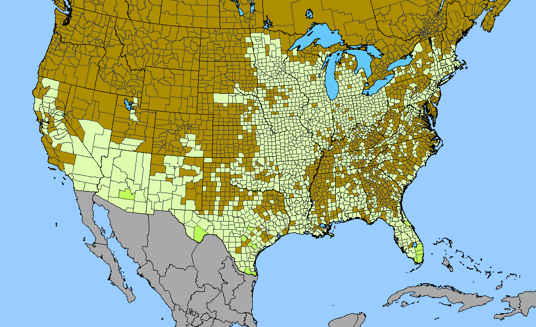
 Density gradient of native species for HALORAGACEAE within the US (data 2011). Darkest green (8 spp. Middlesex County, MA; Worcester County, MA; Carroll County, NH; Suffolk County, NY) indicates the highest species concentration. ©BONAP | 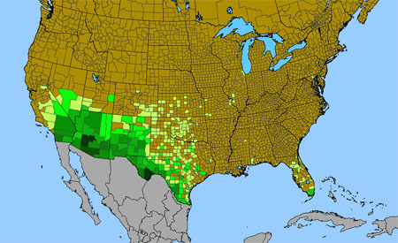 Density gradient of native species for ZYGOPHYLLACEAE within the US (data 2011). Darkest green (8 spp. Maricopa County, AZ; Brewster County, TX) indicates the highest species concentration. ©BONAP | Return to top of Map View Return to Graph View | |
| | | | |
| Graphs and maps generated by David Maliken, Misako Nishino and John Kartesz. | |

